


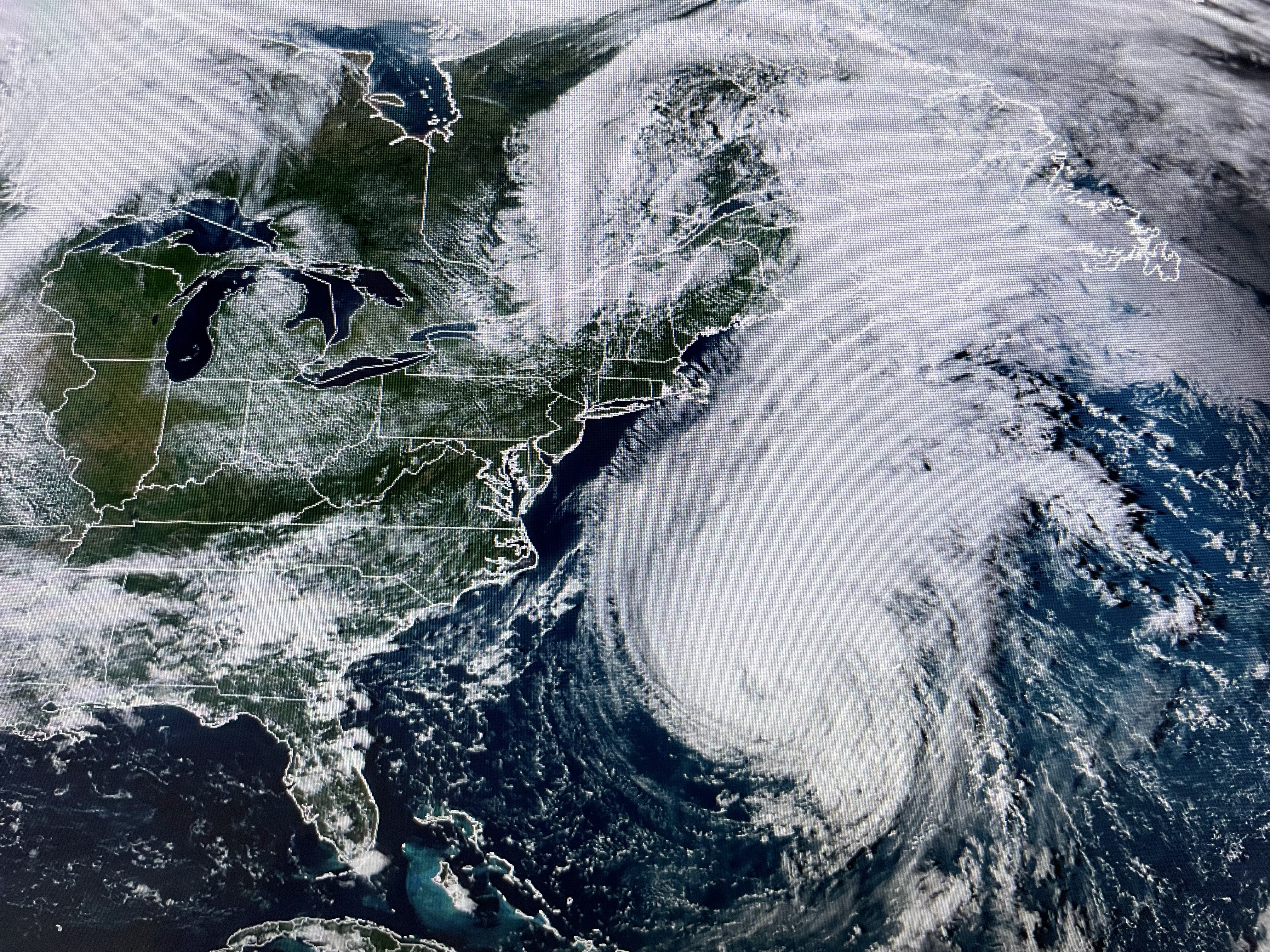


Lee still has a well defined circulation, but the clear eye has vanished as drier air and wind shear rotate around the southern & eastern sides. The rest of the Tropics remain active.


With the current upper pattern, I don't see any way a significant cold front can push through us. The Summer long heat dome has been pushed into Mexico, but the main upper trough is over the West coast and not East coast.


There is a weak frontal boundary aligned west to east across south LA/MS, but Dallas still has a dew point of 70 indicating the drier air is still well north of us.


There appears to be a weak upper disturbance over Eastern Texas that is triggering a wide spread area of showers, but models sort of weaken this system over night. You can see where it's raining, it's cooler.


Until cold fronts start coming, the 7 day is pretty useless. I don't mind the linger warmth since it's not like the brutal 100+ days back in August. Stay tuned!

No comments:
Post a Comment