


There were a few clouds forming during daytime heating as highs neared 70. Winds were still 12-20+ with higher winds offshore. Tuesday morning will see winds much lower and that should allow more 40s & 50s both sides of the Lake.


If you're looking, hoping, wishing or praying for rain, that is not likely until we see an upper pattern shift. Right now, a deep upper low is bringing a northerly (dry) flow of cooler air out of Canada.


It has the eastern states in sweaters & jackets with most of the West almost summer-like.. Dew points in the 30s & 40s will allow nighttime lows to be almost chilly with daytime highs pleasantly warm.


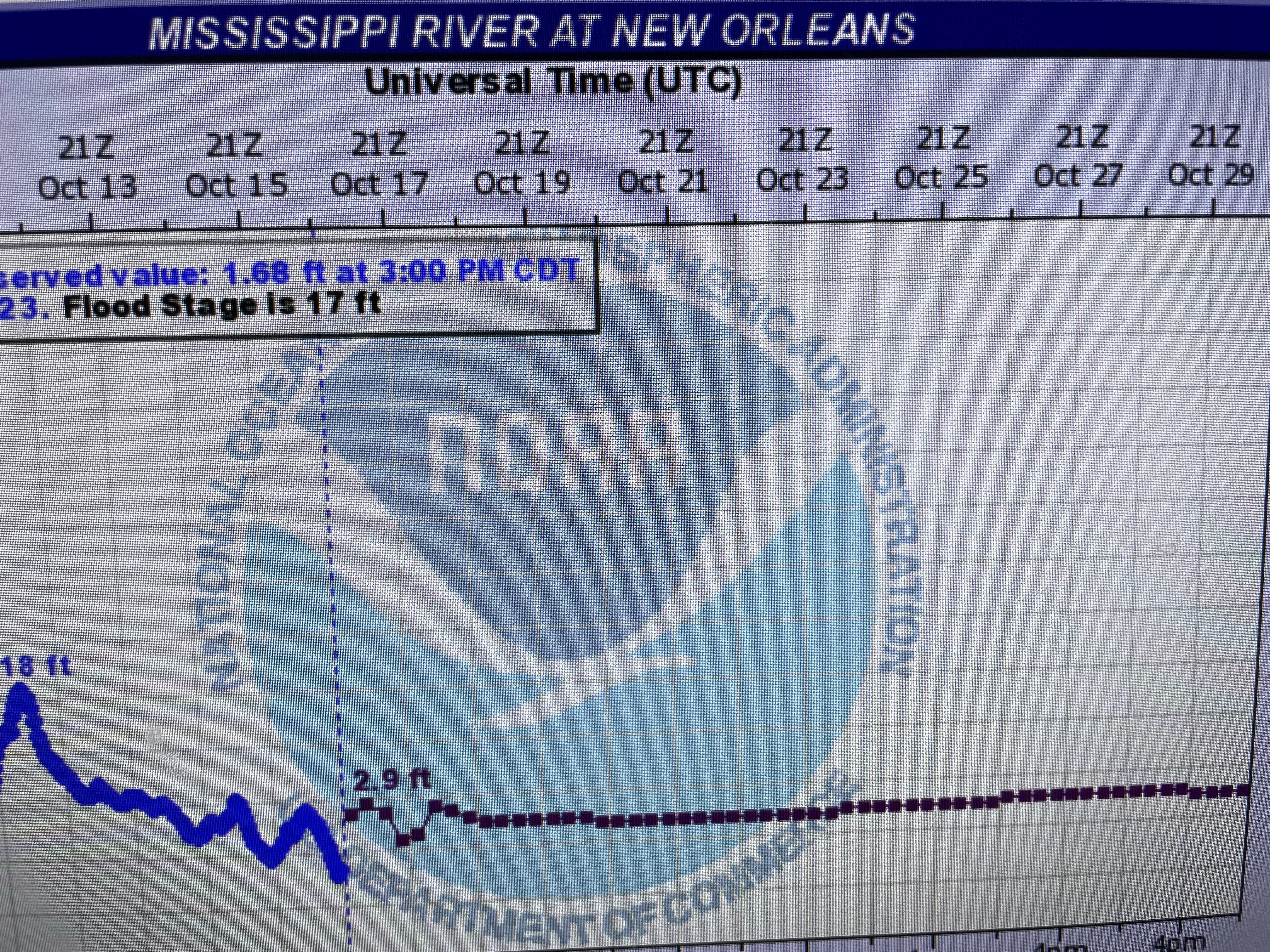
Despite all the clouds over the East, very little rain is falling. The projections for the next 10-14 days are rather bleak and the Mississippi River levels should stay flat. We might see that salt water wedge begin moving northward again.


There is a weak front coming late this week, but rain chances will be limited since the Gulf moisture is cut off.. "When in drought, leave it out". Stay tuned!

No comments:
Post a Comment