

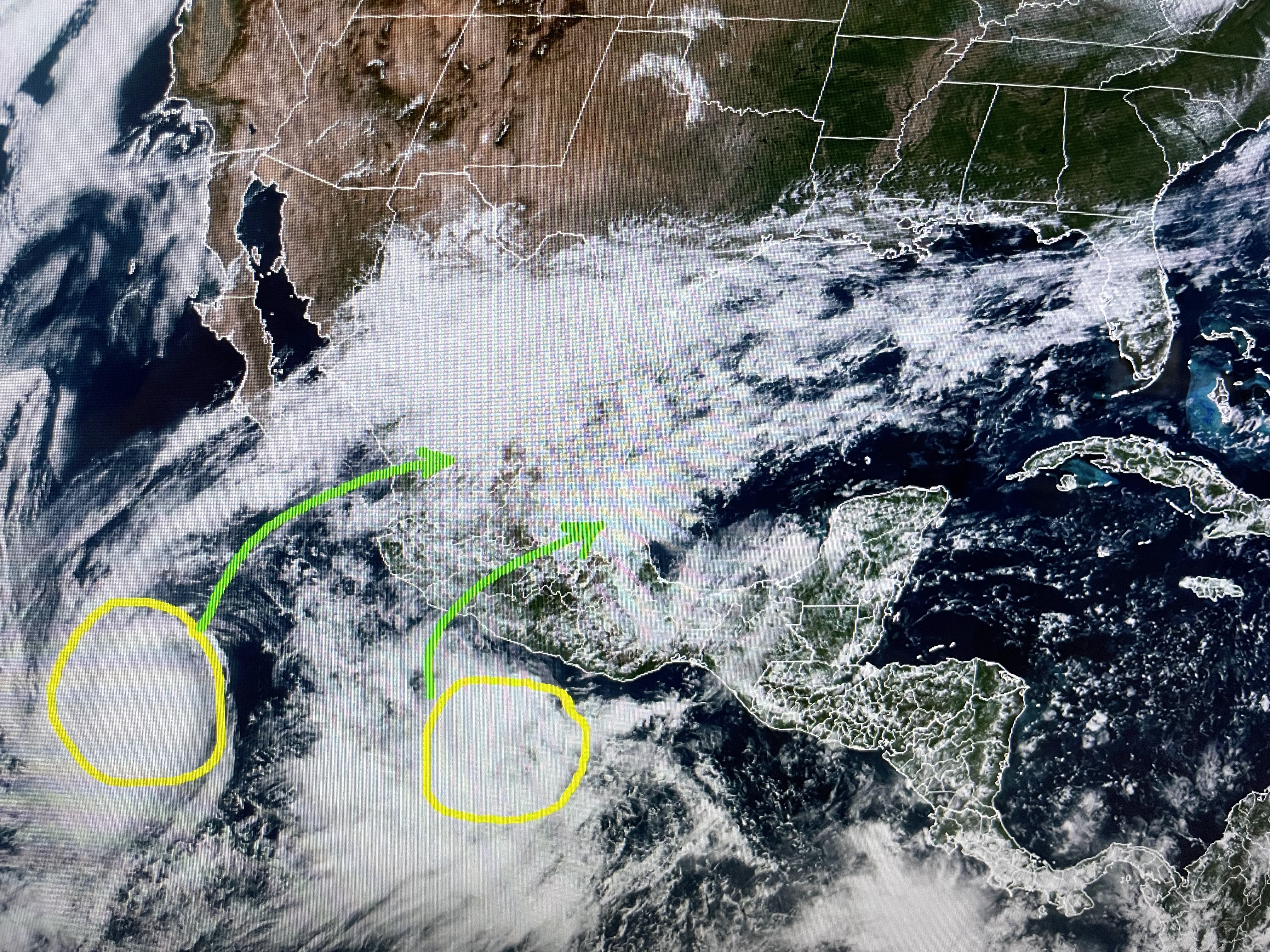
Last night's cold front has pushed down into the Gulf while two tropical disturbances out in the Pacific are projected to head across Mexico by early next week. Their low level moisture will be rung out by the mountains in Mexico, but the leftover energy might trigger a weak tropical system in the Gulf. At least models are hinting at that.
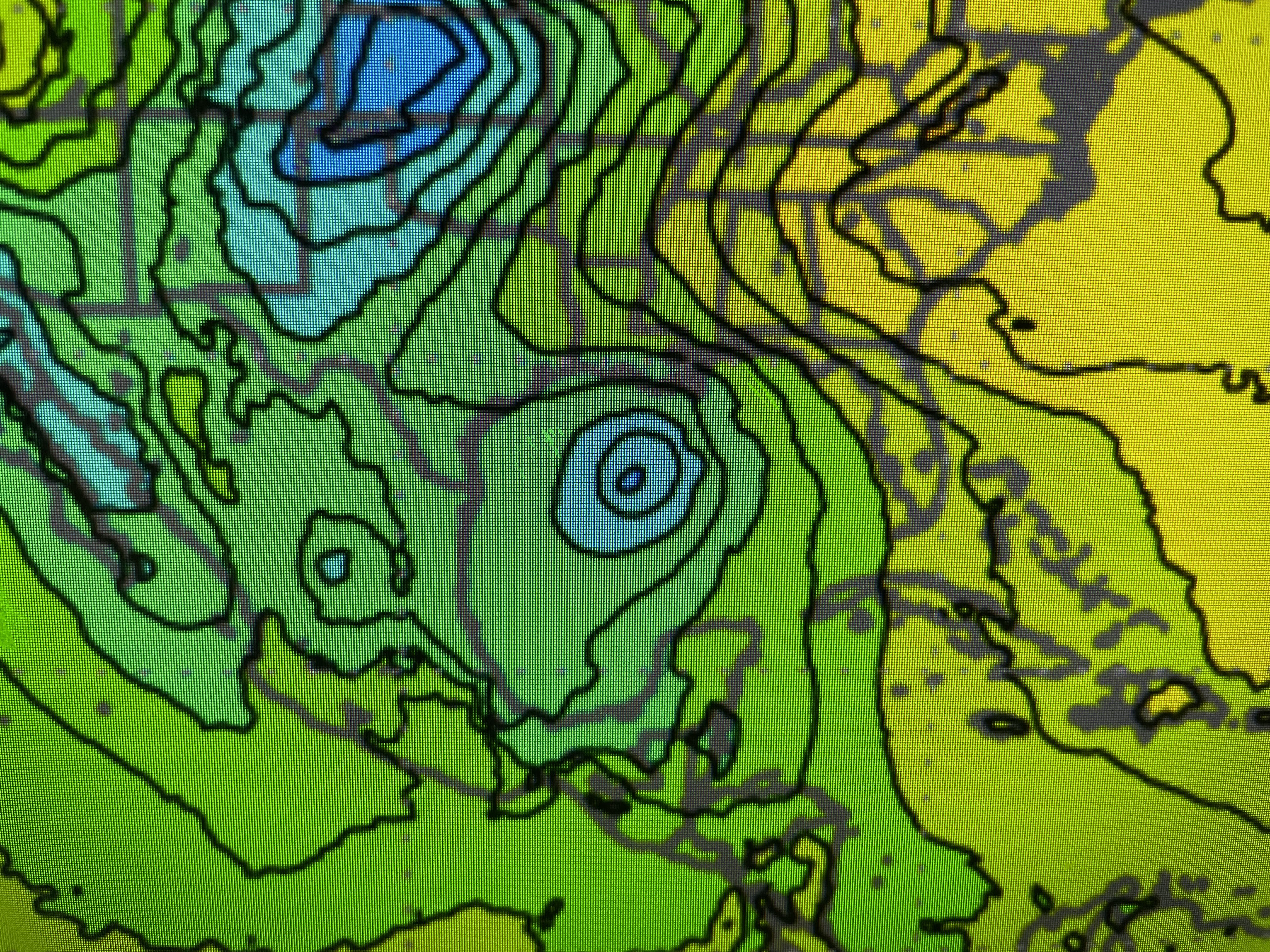


The top view is the Canadian with the middle being the European and the bottom the American GFS. Timing is for late Wednesday into early Thursday. Note, no model develops a strong/major low , but it might be just a weak tropical system that could bring us much needed rainfall. There is nothing there yet and we'll have many days to watch for development.


In the short term, the upper East coast/Great Lakes trough has brought us our first real front of this Fall season. Not only are we delightfully cooler, but the air is much drier. That should allow night time lows to dip into the 40s & 50s.


High, thin cirrus clouds are flying across south LA/MS as highs have stayed into the 70s.

The big story looking ahead will be increasing rain chances later next week. One day at a time Gang. Enjoy the Saints win ( 27-17) tomorrow along with some great weather! Stay tuned!

No comments:
Post a Comment