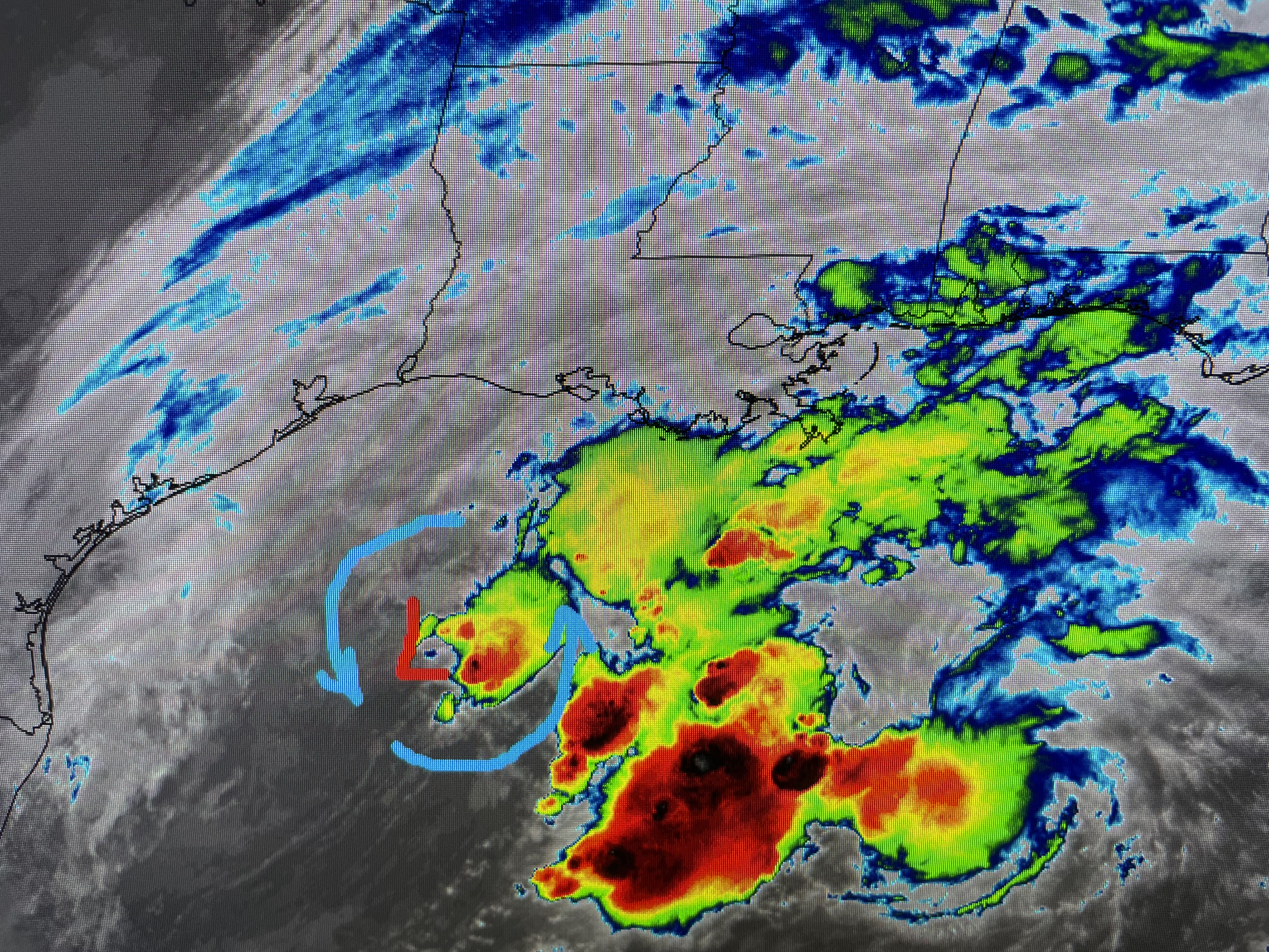
This is a special midday update since I was out fishing yesterday. NHC dropped the area over the western Gulf for Tropical/warm core development, however, that doesn't mean nothing will form and they'll be no impacts. Just the opposite as I'm seeing on the daylight/visible satellite loop a rotation offshore of Lake Charles. The reason this won't become like a summer storm is the roaring upper level wind shear that will not allow a warm core to take over.
The color Infrared view has the colder/taller cloud top well east of the surface center and that's where the heaviest rains should stay. But as this winter-like low develops, there will be local impact this afternoon and tonight. The good news is it will bring all of us some soaking rains.
The NWS rainfall forecast keeps the heaviest well south of NOLA with decreasing amounts the farther north you go. The bad news is increasing ENE winds will result in local tidal flooding and awful marine conditions.
Things will start to go downhill after 1 PM, so if you don't need to be out, stay around home until this disturbance passes. Finally...
I had a fabulous day fishing with Captains Johnny Lewis & Hylton Petit. We caught our limit (75) of speckle trout, many in the 14-18" range. I only used artificial bait while the others used live shrimp mixed in with some plastic. Captain Hylton caught this huge red (34+") that took him 10-15 minutes to land. Of course he released it as we only kept 3 reds in the 16-18" range. We'll be back trying again next week as Fall is my favorite time to fish. I'll post again after 4 PM. Stay tuned!


No comments:
Post a Comment