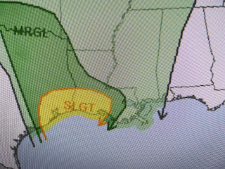
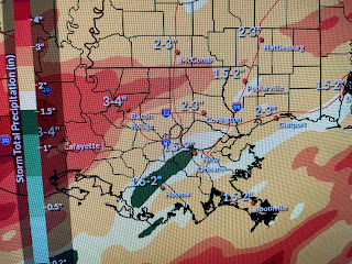
Nicondra showed us a graphic at 4 PM that suggests the heavier amounts will be to our west and north of Lake P. The bottom graphic is the NWS amounts. Below is the satellite view with the low over Texas and the warm front coming out of the Gulf.
So if you're going out this evening, take the rain gear. The first rain wave races by tonight with the next coming late Friday and another early on Saturday..
The timing may change and Friday will see many dry hours. Here's the timing from Amber Wheeler.
The rain should move away on Sunday with a dry spell coming for next week.
No real cold air follows until later next week.
So when you see the FOX 8 First Alert, it is mainly for the POTENTIAL heavy rainfall, not severe storms during the next 2 days. Stay tuned!


No comments:
Post a Comment