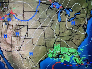
For one thing, the predicted surface low over the NW Gulf never formed. Instead we have an inverted trough with several ill defined mid level lows to our east and an open weak circulation south of Morgan City. This system , as they say, never got it's act together. Why not? Here are my two reasons.
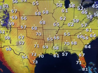
The northern Gulf water temperatures have cooled into the 70s reducing the "fuel" for development. In addition, we have no cold air to contrast with warm air like what happens in the Winter. It's warmer in Denver than here! That's due to the upper flow pattern across the nation.
Without an eastern upper trough, the cold air stays bottled up in Canada, where the cold is building. We're starting to see below zero temps show up. it's only a matter of time.
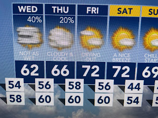
In the short term, low clouds will linger along with a few showers on Wednesday. We're in day 5 without sunshine.
As sunshine returns late week into this weekend, temperatures will rise back to 70+. Another front approaches next week.
Finally, NHC has scheduled a recon flight down to an area of disturbed weather in the Caribbean. Will it be Vince? He will not be our problem. Stay tuned!


No comments:
Post a Comment