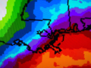
You can kind of see that the heaviest amounts will stay down over the Gulf with most of us seeing 1-2" at best except down along the coasts. So why won't we see the heavier rains?
The upper support appears to be there with a disturbance over west Texas lifting to the northeast. There is a frontal boundary draped along the northern Gulf but, as Nicondra showed us at noon, that surface low will remain far offshore keeping the really heavy rains well south. Here's something else to think about.
Where's the cold air? The frontal boundary is to our south, but look how it's actually warmer to our north under sunny skies. We're lacking the temperature contrast to really get a potent system going. But that's OK since our gentle, steady rainfall will soak into the ground instead of running off.
So we have another 24 hours+ of rainfall to go, IF you believe in the computer model. Bottom line, this system may not be a "drought buster", but it will cut into the short term dryness. It's just what our lawns & gardens needed. There will be some impacts for communities along the coast & outside the levee protection system.
The strong easterly winds will bring some higher tides and minor flooding so pay attention.
Once this surface low pulls away & sunshine returns, our temperatures rebound back to 70+. I don't see any strong cold front coming before Thanksgiving. Finally...
NHC, based on computer models, keep calling for a named storm later this week and head towards Jamaica, eastern Cuba & Hispaniola. They're trying to get two more storms since that will complete the list of names for Hurricane season 2023. Stay tuned!


No comments:
Post a Comment