


The top graphic shows the driest years. So far in 2023, MSY's total is 37.80", but we should get another 2-3"+ during the next 7 days (bottom graphic). The 7.40" at MSY for this December so far is only 1.25" short of breaking into the top 10 wettest on record. My guess is we'll end up as the 3rd or 4th driest year and the 6th or 7th wettest December. Funny how the weather patterns seem to flip-flop between too little or too much, or too hot or too cold. Speaking of a flip flop. Look at todays upper air pattern with the computer forecast in 2 weeks (first week in January)


The top view is today's pattern with troughs off both coast with a weak ridge in between. The second view radically switches to ridges off each coast with a deep trough over the United States with a northerly flow straight down from the Arctic. Canada is seasonally cold so expect the New Year to get off to a much colder start. The super cold (40-50 below) air hasn't moved into Alaska as it remains over Russia & Siberia. IF this upper pattern shift proves to be reality, I will be watching to see if the Super Cold follows the flow.

Hannah Gard showed us at noon that so far this month (with the exception of Dec. 9th) we have been fairly "normal" to slightly above. That won't change until the western trough moves to the east.


You can clearly see the affects of the upper ridge as Denver is in the 60s, much warmer than us. Several weak upper disturbances are sending high, thin clouds streaming across Texas in Louisiana resulting in filtered sunshine.


The seasonally cold air covers most of the Great Lakes & Northeast, but by their standards, it's not all that cold.

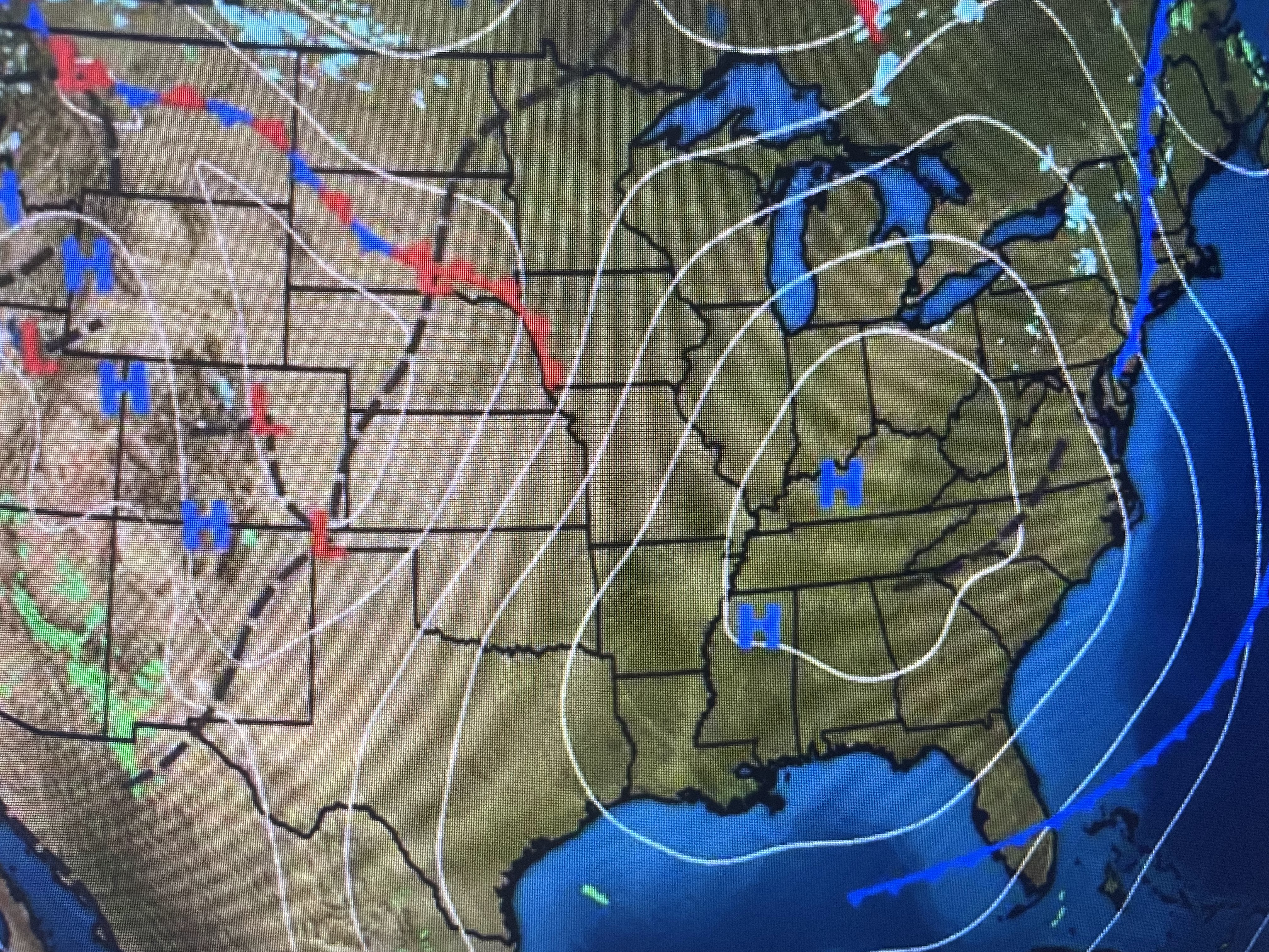


Cold, dry air is still surging down over most of the Gulf with only far south Texas beginning to see any return flow. That should mean on rain chances for the next two days stay near zero with some showers possible on Friday, but more likely over the Christmas weekend.


The high, thin clouds may keep temps up a little tonight, but with light winds the NWS forecast has another light freeze over parts of the North Shore & inland Mississippi. I'm leaving my potted plants outside.


So get ready for another wet weekend at times and perhaps some 70-75 degree warmth that will certainly not make it feel like Christmas. For all you snow geeks, pay attention to that upper pattern coming for January. IF we get into some Arctic air and IF a low were to form down in the Gulf, who knows! Stay tuned!

No comments:
Post a Comment