


Amazing to see no snow on the ground from Minneapolis, Green Bay, Chicago, Detroit, Cleveland, Boston & even Buffalo! Locally, compared to last year, Christmas Day could easily be in the 70s with early showers & clouds giving way to bright afternoon sunshine. Let's focus on the timing of the coming rains

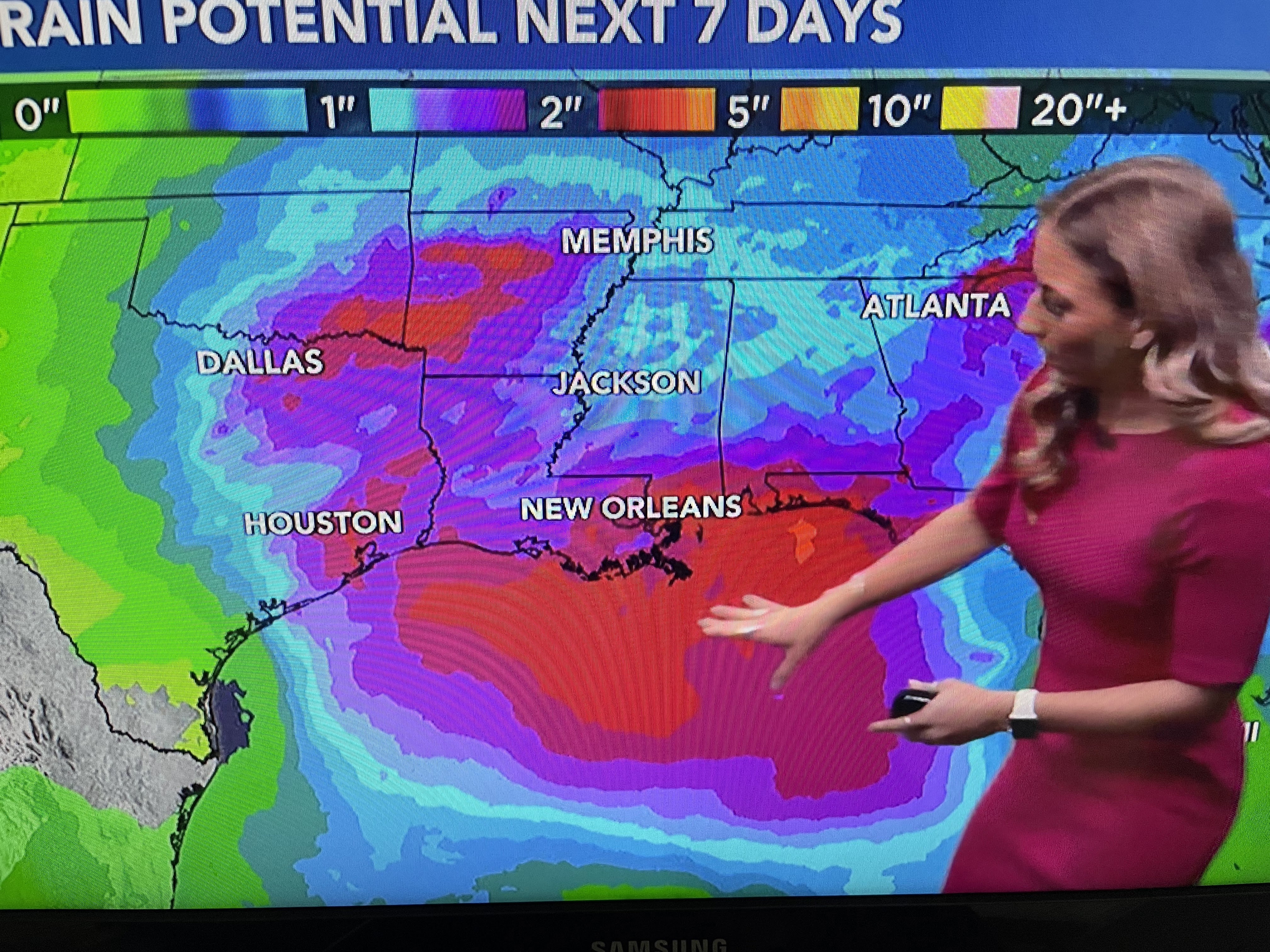

The day with the highest/best rain chances is Sunday where we could see some potential street flooding. FOX 8's Weather Team has a First Alert/Heads Up as the 7 day rain potential is for 2-4. if that total is spread over 2-3 days, flooding should be limited. Now let's get to the why of the forecast.


Winds over Texas have already turned back off the Gulf (green arrows) bringing in clouds and warmer air. The cool (not cold) high over the eastern states is retreating taking the dry air with it. Note the 70s over south Texas & dew points already near 60. That's coming our way. There is a large storm off of California that will finally head to the east.


This storm will stay well to our north, but as the upper trough heads our way, several waves of rain will move across the Plains and over the eastern states. Here's the model (GFS) timing. The top view is valid for Friday morning with most showers well o our north.


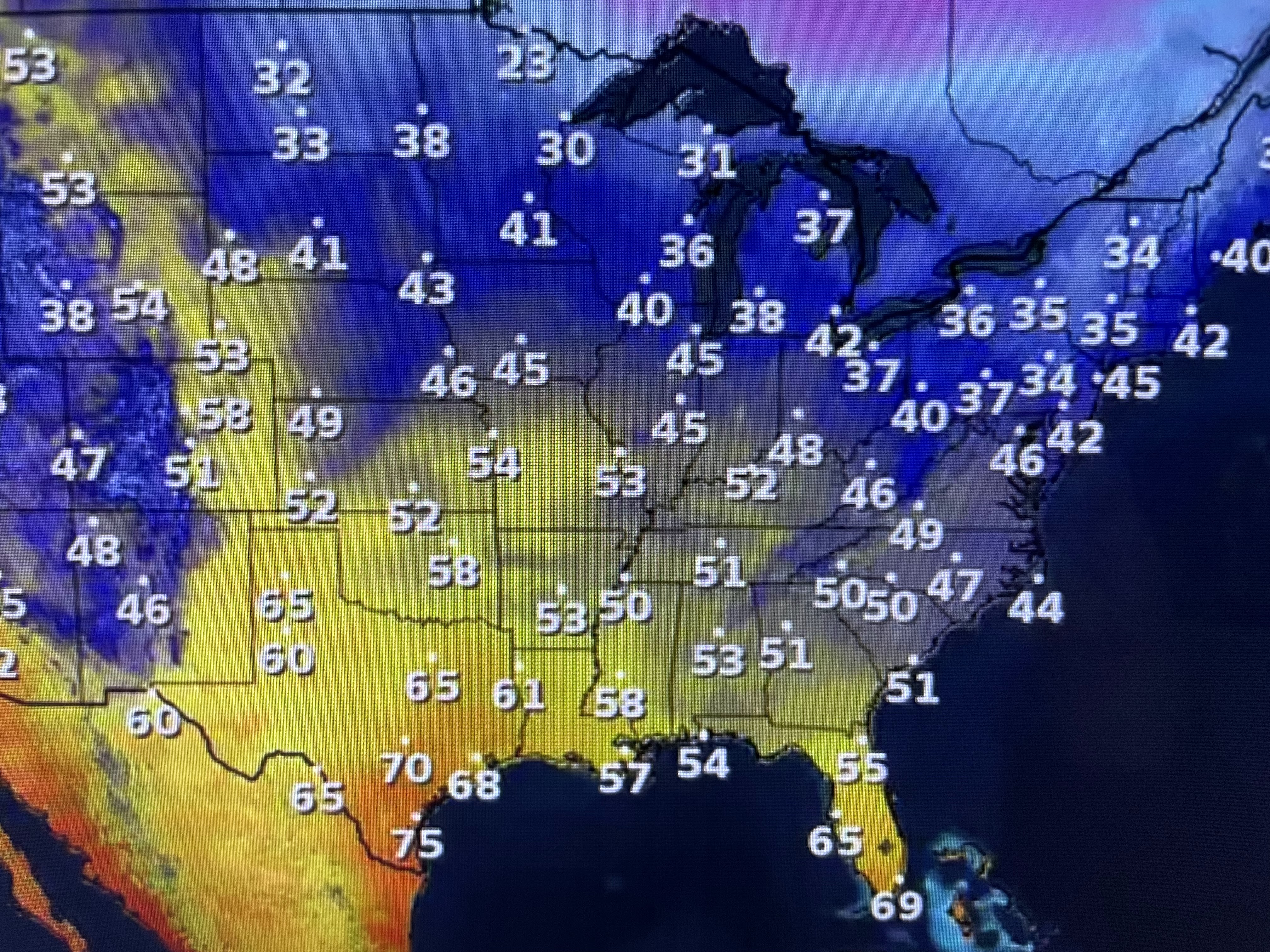
The next view is for Saturday morning with a few showers mainly along our coast. However, the next view is Sunday morning followed by Monday AM & PM. Note, by Christmas PM, skies clear as the rain is long gone. With west winds behind the front, highs easily could be mid to upper 70s! Hardly a Christmas feel!


So for those of you traveling by car to Grandma's house, you don't need to deal with any icy roads. If you're flying, expect this western storm to create many travel delays as you try to get with families. Finally, all you cold air & snow geeks...


yesterday I showed you the computer model guidance looking out two weeks. The top view is the upper pattern this morning showing that storm off the West Coast and the departing eastern system. The second view is for Thursday evening Jan. 4, 2024. Note the deep trough is now over the Great Lakes down to the Gulf South. It is consistent with yesterday's model run. So, IF that proves true/reality, look what's up over Alaska & northern Canada. No Super Cold (40-50 below), but plenty of cold (20-30 below) air that MIGHT bring us a hard freeze threat for early January. Let's watch it to see if that model trend continues. For our short term, we're warming up. Stay tuned!

No comments:
Post a Comment