
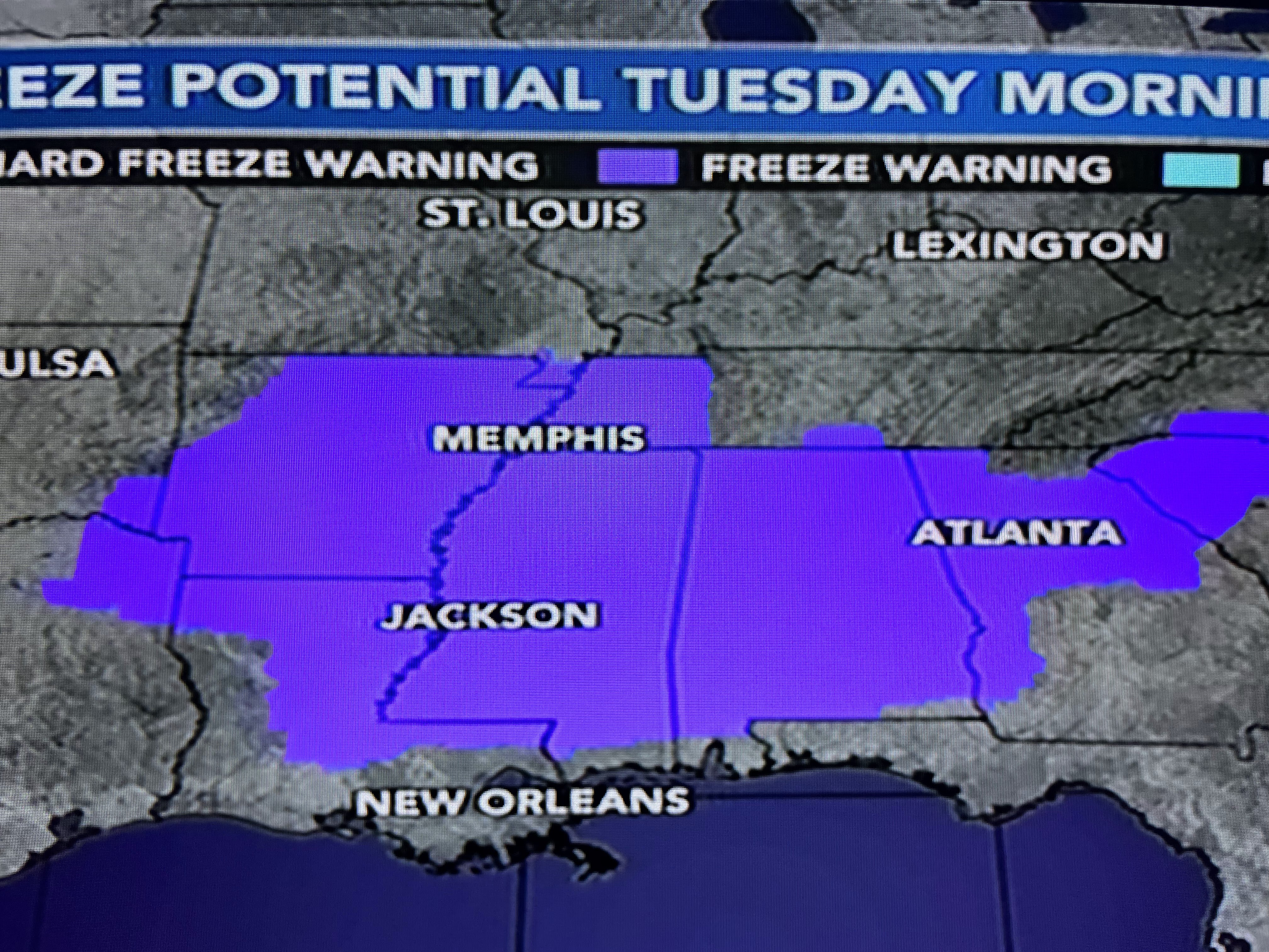


After seeing how accurate the computer models were with our weekend rains, I'm not about to go against their guidance regarding morning forecast lows except to say I don't believe it will get that cold. Why would I feel that way? To get to the predicted lows 1) skies must stay clear and 2) winds must decrease to near calm.


The North Shore will stay clear for many hours tonight, but even up there, some high clouds should return before dawn. My real thinking says the winds won't totally die off either especially over the South Shore where the 60+ degree waters of Lake Pontchartrain will keep us mainly 45-50 degrees. So where is this cold air coming from & why is it coming southward to the Gulf coast? the upper low is still stuck over the SW, but look at the big dip/trough over the Great Lakes.


That flow is driving down winter-like temperatures along with some Lake effect snow showers. But the chill won't linger over the South. Once the center of the surface high (now over Kansas & Oklahoma) shifts to our east by Wednesday the warm up begins.


Note the temps in Montana are up in the 60s. The dew points have fallen into the 20s & 30s over us and that dry air should limit any frost formation. I'm not doing anything with my plants since the South Shore will not get that cold. Those of you north of I-12 might protect any tender plants (tomatoes), but most of us are fine.

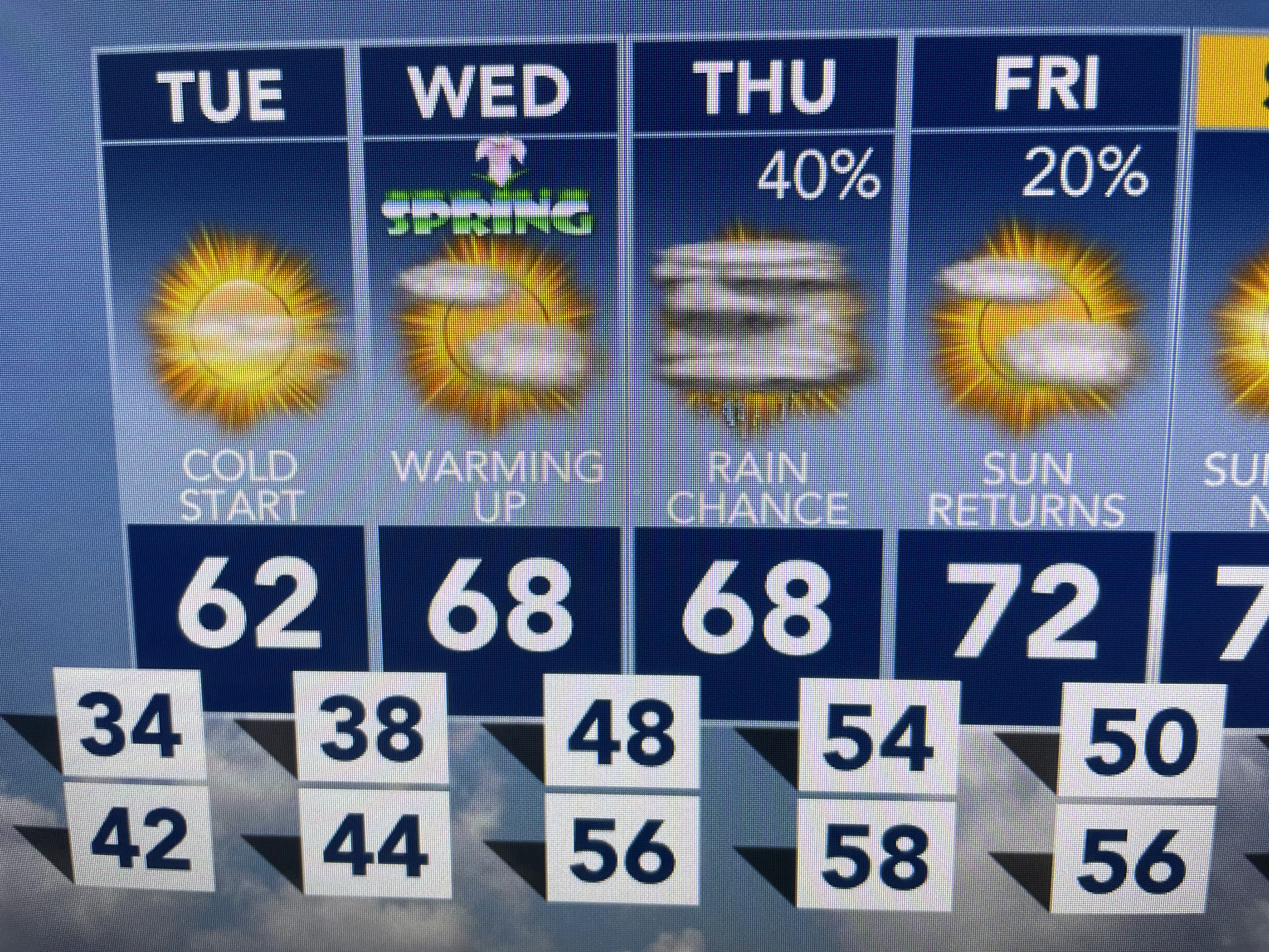

Our next rain threat arrives late Thursday, but it doesn't look anything like this past weekend. Enjoy the chill, wear your sweaters and say goodbye to Winter tomorrow night. Stay tuned!

No comments:
Post a Comment