


According to the SPC (Storm Prediction Center) outlook, the main severe threat (Level 2) on Thursday will be over the Texas coast with the heaviest storms staying south of us. Nicondra showed the model forecast timing at 4 PM. The highest rain chances don't arrive until after 4 PM.

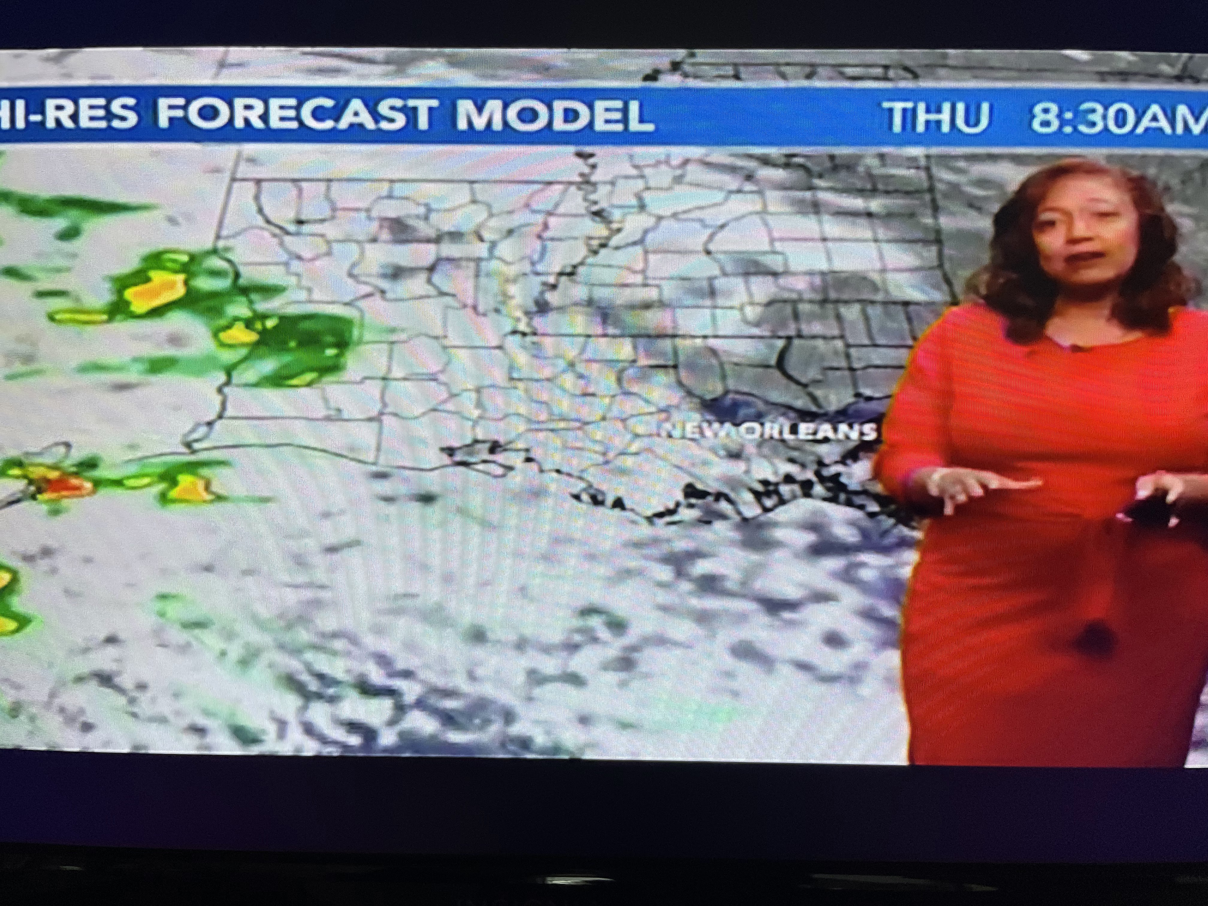


There could be several rounds of storms on Friday as the upper low track just to our north. That storm is still back over Arizona and that is why most of the daylight hours on Thursday will be dry.


Our dew points are still very low (40s) with the slug of low level moisture (60+) moving northward over south Texas. This last cold spell is on full retreat over the Gulf South, but it remains Winter-like over the Great lakes & Northeast.


Locally, you will notice increasing clouds for tomorrow along with higher humidity.


Even though a weak front will follow the upper low on Friday, the airmass is of Pacific origin resulting in a very mild/warmish weekend.


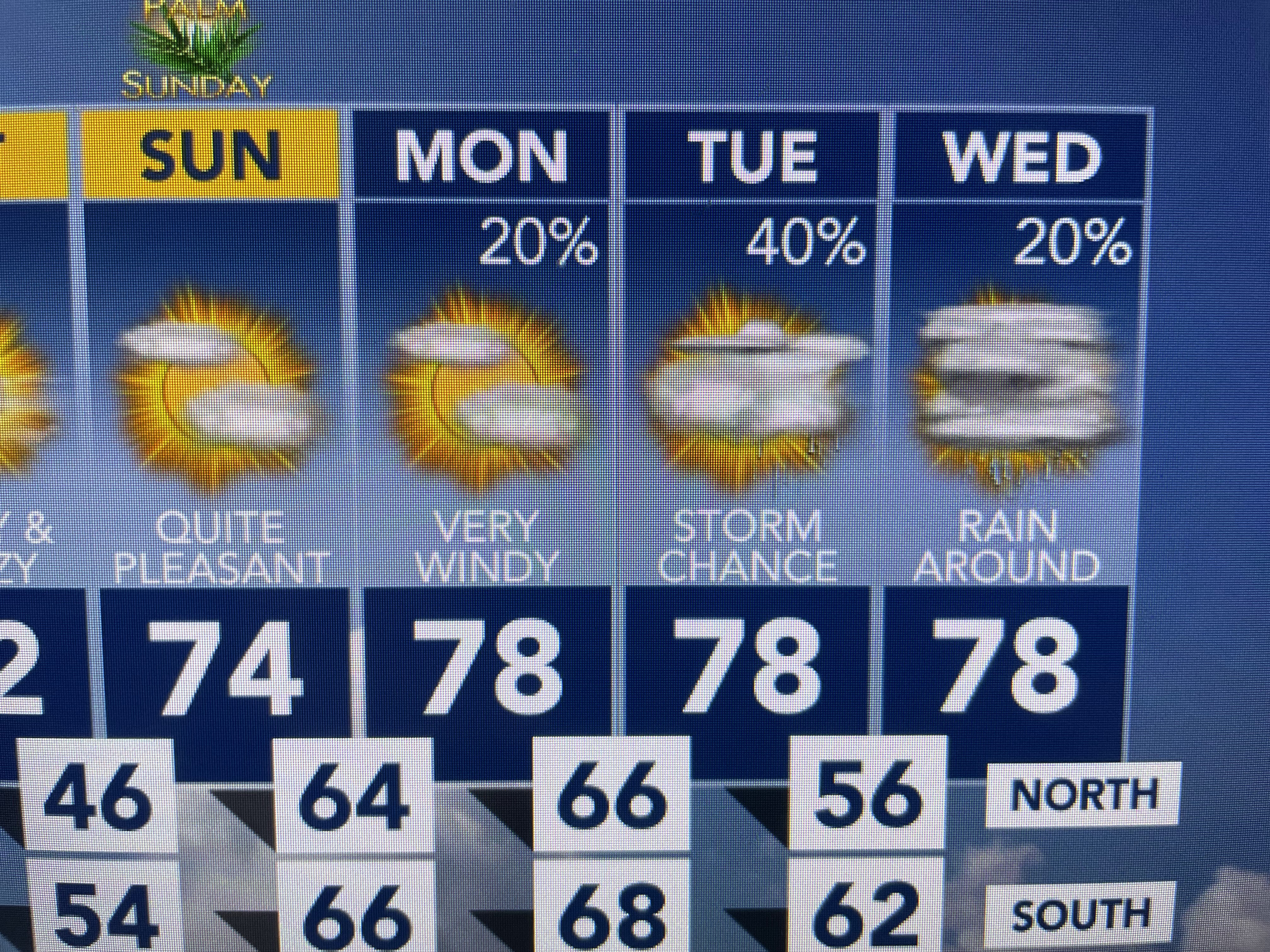
The next rain system early next week MIGHT bring a greater threat for severe storms, but we have many days to watch that. Finally, if you missed Zack Fradella this morning, you missed this cool view of downtown.


With clear skies & light winds, a shallow layer of fog developed well AFTER sunrise. It wasn't right on the ground so it caused no travel problems. Just thought it was a really neat weather picture. Stay tuned!

No comments:
Post a Comment