


With the second weekend of Jazz Fest coming, we may luck out staying mostly dry. Why? There remains a weak upper ridge over the Gulf steering storms up and around us, Monday's storms being the exception.

So the upper pattern keeps severe storms reforming over the same states farther to our NW. SPC outlines their severe risk outlook for the next 3 days. The top graphic is valid for today, followed by Wednesday & Thursday's outlooks.


Tornado watches are currently up again for states battered by tornadoes over the weekend. Radar confirms new storms firing off where SPC predicted.


The seven day rain totals extend from Texas into Minnesota. Very little rain reaches us.


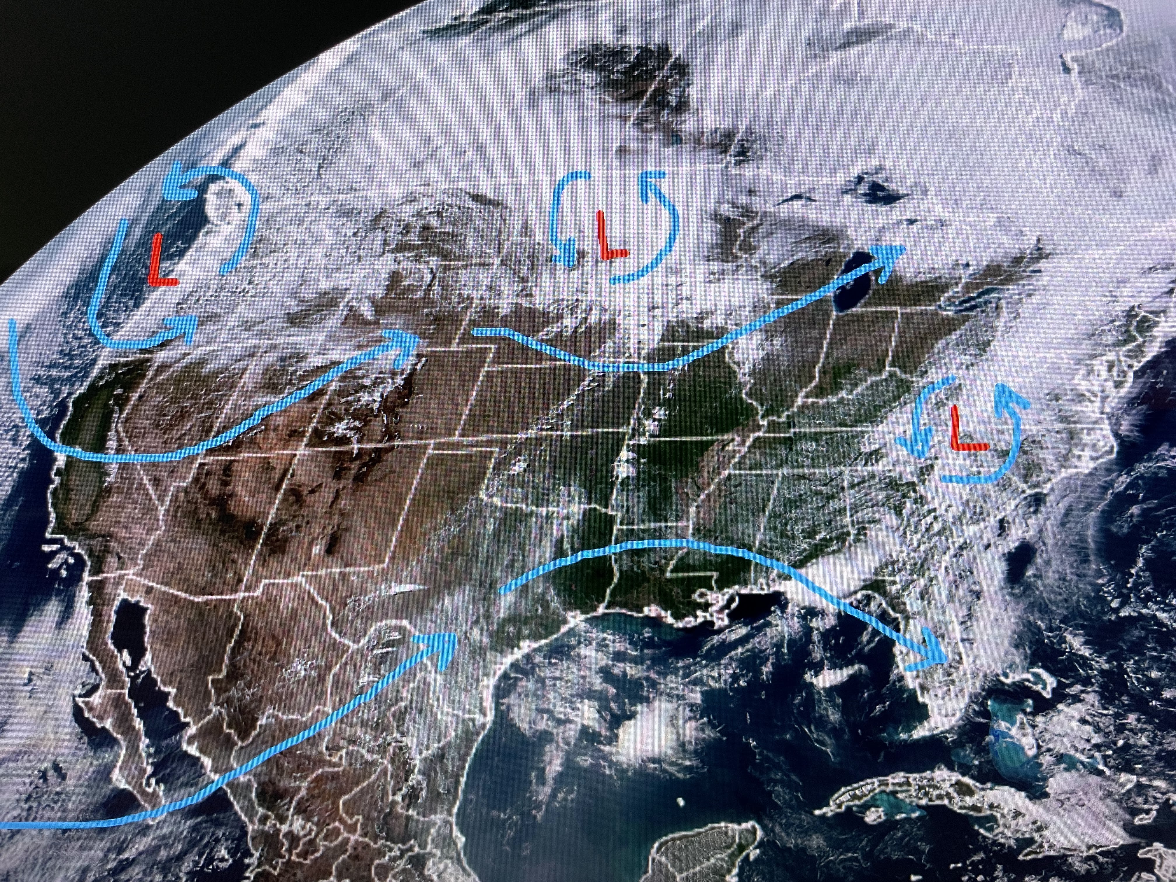
You can see the large area covered by warm air with the bottom graphic having dew points 60+ (very humid) surging northward up to Omaha. Nicondra pointed out how the computer model keeps developing storms to our west, but they weaken greatly before reaching us.


So, yes Friday has the highest rain chances, but the system weakens nearing us and that should mean no lightning.


So don't get too concerned yet with the 40% rain chances on Friday. The Fest will roll on as long as there is no lightning. Finally,


The jasmine on my back fence continues to bloom. Usually, the flowers only last 10-14 days. Monday's soaker seems to have given them new life. Next to flower are my crepe myrtle trees. I just love Springtime! Stay tuned!

No comments:
Post a Comment