


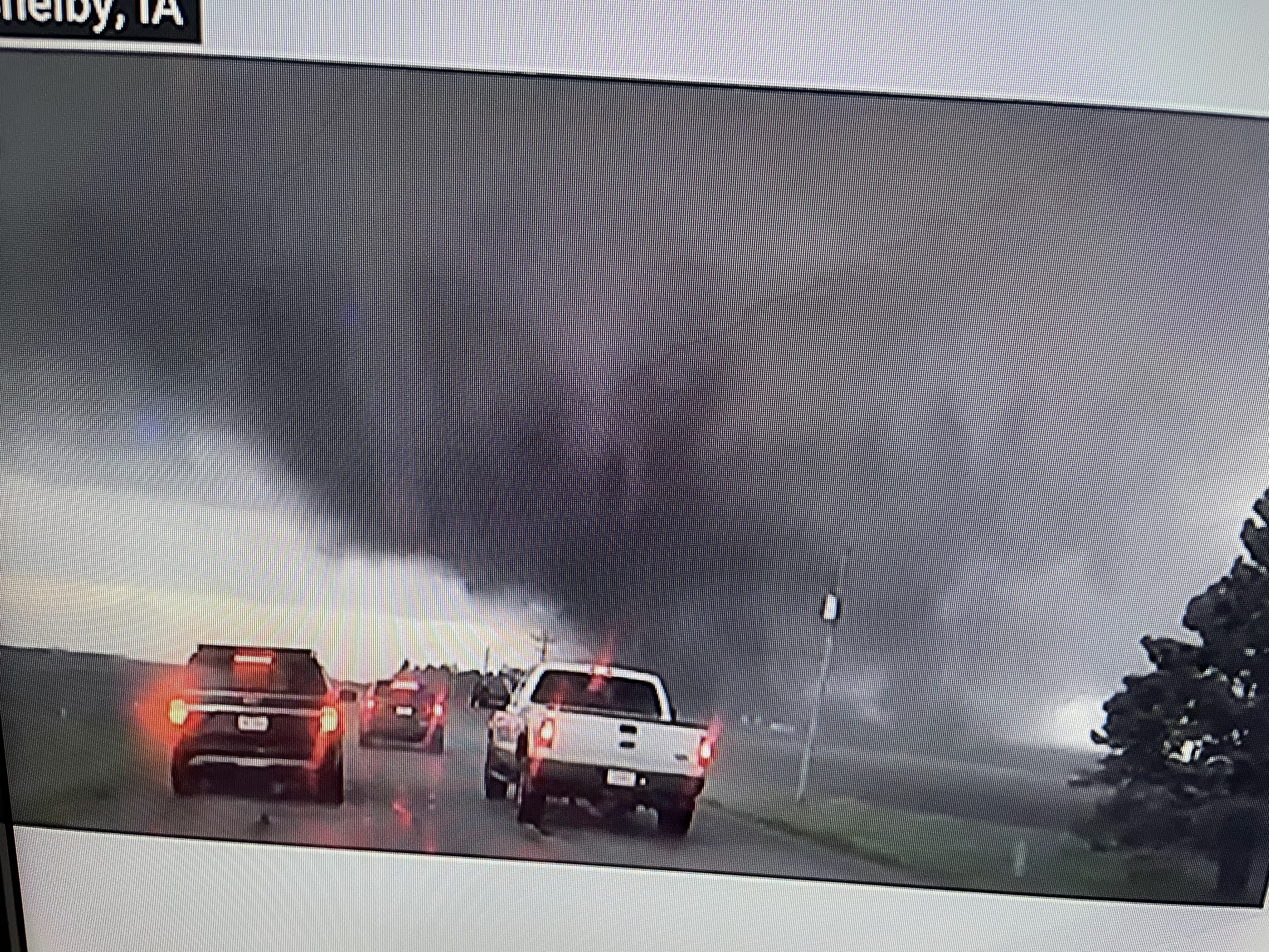

Can you believe all the cars/SUVs chasing this killer? Are they all JFN? ( Just Effin Nuts!) Don't they know past history? But as the tornado rumbled, I captured several pics of "suction vortices" (funnel within the funnel) that Dr. Ted Fujita discovered during his tornado research back in the 70s & 80s. it was a classic wedge tornado, but on the closer views you can see the other funnels.


The bottom graphic is the classic radar signature of a hook or the number 6. This was just one of many tornadoes YESTERDAY. SPC has reloaded farther to the west for today with a level 4 severe risk for TX,OK, KS.


So what is going on? Basically, we have an upper trough over the western states with a ridge over the eastern states.


Look at the temperature contrast from the 30s over the Rockies to 70s & 80s across the Plains and into the Great Lakes. In addition, the bottom graphic has dew points 60+ up into Wisconsin & Michigan, The chasers are out in full force again this afternoon.


Locally, we're warm, windy & humid and that won't change for Sunday.

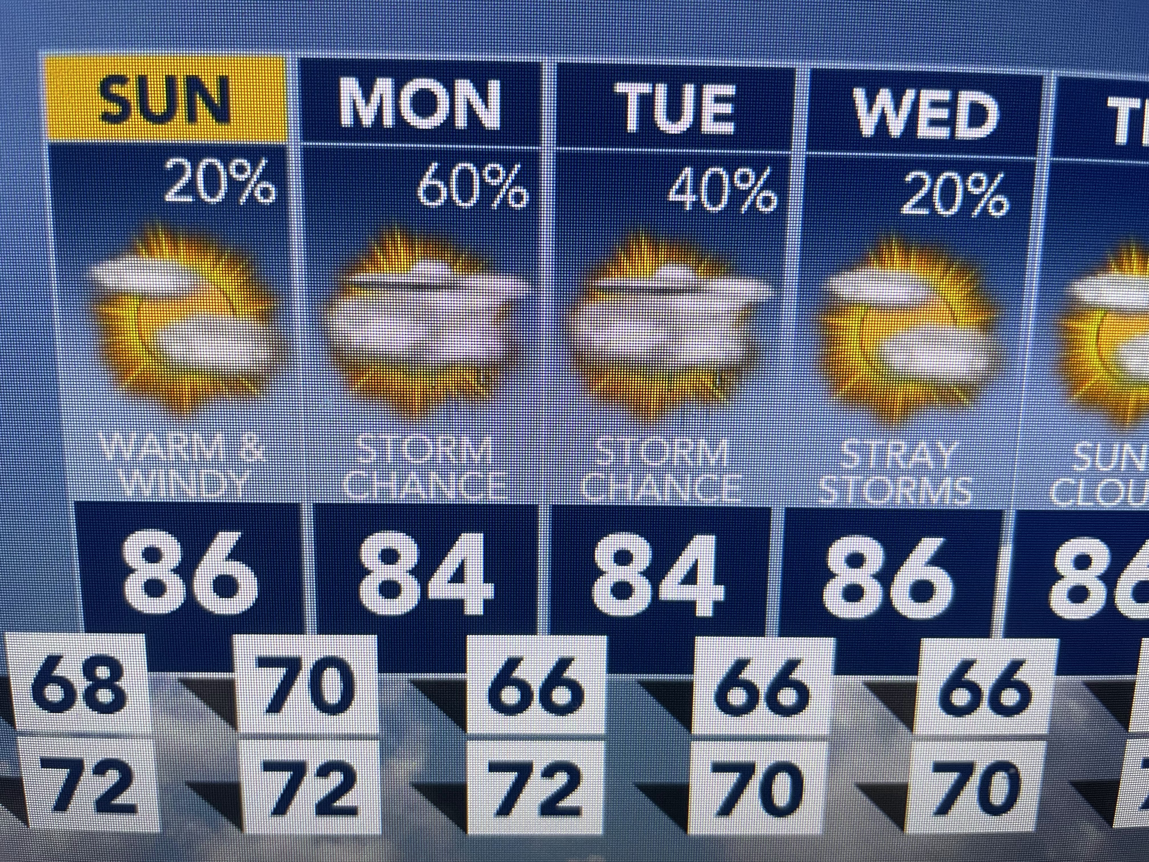

Monday & Tuesday may see slightly better rain chances, but no real cold front is coming and we're running out of time for that to happen. So Tornado Chasing is for those experienced in meteorology. Even still, the danger for death is there so I suggest you leave it to the Pros. Stay tuned!.

No comments:
Post a Comment