


The second view has a strong upper disturbance diving to the SE out of Oklahoma & Texas that will arrive after midnight. SPC has 2 severe T-Storm Watches (yellow boxes) with a Tornado Watch box (red) south of Dallas. For us later tonight, I see more of a straight line damaging wind event with the tornado threat rather low. SPC's outlook follows showing the large area under a level 3 severe risk from Texas to Georgia.


This is a complex upper pattern that should finally drag a cold front through for Saturday. The low over Iowa is the upper energy that will drive the frontal boundary through us during the day tomorrow.


The first storm complex is pushing through Georgia with the second now back to our NW. These storms will be to our east before daybreak with the highest rain chances being across the North Shore. The FOX 8 model, like yesterday, underplays the storm threat.


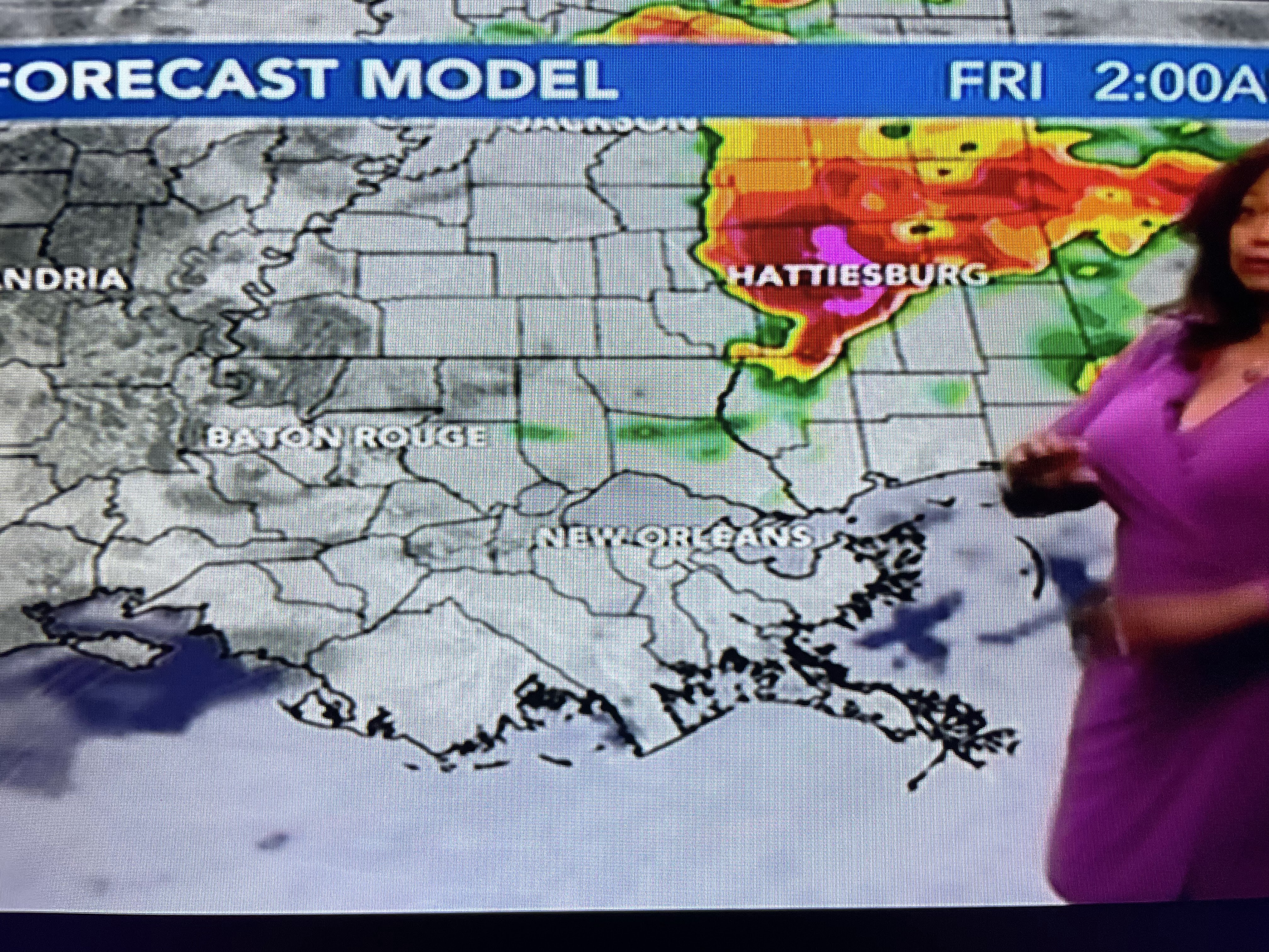
I'm thinking we'll see more showers farther to the south, but the main point is, the real severe threat will be north of Lake Pontchartrain. Make sure you have your cell phone near your bed as you go to sleep. The FOX 8 Weather App will alert you if warnings are issued for your location. Nationwide, there is still an upper low over the Rockies that is keeping them quite chilly for May.


Tomorrow's cold front will not last very long. You'll notice a different feel to the air during the afternoon and especially after dark. Mother's Day will start out fine, but clouds will be on the increase as that muggy feeling returns.


Notice the drop in dew points between OKC & DFW. That's the drier air coming down behind the front. Those 75-80 DPs will provide the fuel for storms later tonight.


Enjoy this drier feeling Friday afternoon into early Sunday as next week looks really rainy. WPC's 7 day total rainfall graphic paints widespread 5"+ amounts all along the northern Gulf Coast.

Finally, Zack showed a graphic showing us breaking the warmest over night lows.


So the next thing to watch for is our first 90 degree day. Well, watch no longer as MSY briefly touched 90 at 1:56 PM. Let the Summer begin! Pay attention tonight & stayed tuned!

No comments:
Post a Comment