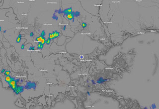
After several days of no rain on radar from Texas to Florida, a weak frontal boundary has sagged down into the Gulf South triggering widely scattered T-Storms. Actually the rain is welcomed since it helps keep us less hot. But coverage is so limited and more dry air is coming.
The current frontal(dry air) boundary is being pushed southward by an east coast upper trough.
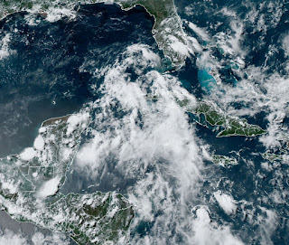
You can really see the boundary in the much lower dew points (50s) in the bottom graphic. Models are staggering that boundary down off our coast for the rest of this week and that means we'll be mostly dry & very hot. So let's focus on where all the hype is on the internet...the TROPICS. There is a surge of tropical moisture over the western Caribbean, but for this week that surge will be blocked from us by the dry air moving down from the north.
Clearly, there is nothing forming down there yet and NHC doesn't have it outlined in their Tropical Outlook. Still, the heavy rain threat for south & central Florida is real for the rest of this week. I grabbed this graphic off The Weather Channel.
Whether a circulation develops or not, all of Florida from Tampa-Orlando-Daytona should pay attention for the next several days and expect some street flooding with widespread heavy rainfall. The GFS model continues to go nuts with bringing moisture westward by this weekend and even develops a storm in the Gulf south of us heading into Texas in the 10-14 day time frame. The Euro does not so I won't get concerned until NHC at least starts to mention something in their daily outlooks. Clearly the GFS model has a problem beyond 4-5 days.
The FOX8 7 day does increase rain chance for Father's Day into next week, but as the local NWS office said, there is low confidence in that forecast. After many days of hot (mid 90s) and mostly dry weather, we'll welcome a few rainy days. Stay tuned!


No comments:
Post a Comment