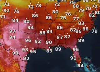
Below the satellite view is the upper air graphic for today showing the heat dome (reddish) over us & Texas. But look how that changes by Wednesday of next week. An upper trough dives down replacing the upper heat ridge with colder temps aloft. That will result in an increase in clouds & daytime heating T-Storms. In addition, the Central American Gyre (CAG) could funnel in tropical moisture. The Weather Channel & the internet has been talking about the CAG all week. What is it? I found this graphic from FOX 4 out of Dallas posted by my former intern Meteorologist Dylan Federico.
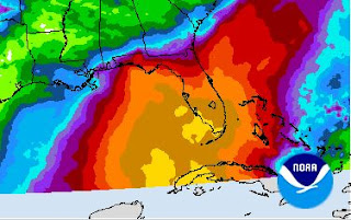
It's a natural area of lower pressure over central America that some times spins up a circulation over the western Caribbean. You can see how that sets up today. The bottom graphic is the WPC's 7 day rain totals that brings that tropical moisture into Florida. NHC is not yet talking about it, but I expect they might by early next week. Remember that blow up yesterday off of the Yucatan?
You can see nothing has developed, but there is an west to east orientation of T-Storms. This is an area to watch for late next week. The upper trough coming down for Wednesday will be our next weather maker. We came so close to getting into the much drier air.
We'll stay dry again on Sunday before rain chances slowly increase for next week.
One thing the rain returning will do is keep our highs down from the middle 90s to the upper 80s. I'm grilling some of the redfish we caught this week on my back patio. I'll have a cold beverage to help me deal with today's heat. Stay tuned!


No comments:
Post a Comment