There are certain things in life you gotta try once. River rafting should be on your bucket list. After a wet stretch, we've dried out and heated up.
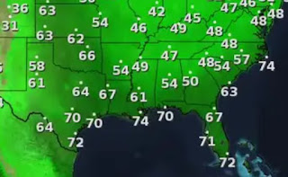
It's a rare summer day when we see no storms between us & the Florida beaches. Drier air has spread over us at the upper levels, but surface dew points remain high, especially south of Lake P.
Tonight may see some of that drier surface air filter down from the north making morning lows feel quite comfortable the next two days.
Better enjoy this dry spell as models are indicating a wetter pattern coming for next week. NHC indicates no tropical activity for the next seven days. Let's review what is going on from Africa to the Caribbean. First off, it's way too early to see tropical/easterly waves coming off of Africa. Typically that starts after July 20th. What we do see way out there is Saharan dust, which will keep things quiet for now.
Closer to the U.S., we find several clusters of T=Storms with one that captures my interest over the western Caribbean.
We've seen this happen already this season where one day it's there and gone the next.
NHC isn't talking about this, plus our current upper flow would keep anything away from us.
Currently, the upper heat dome is our friend (like last summer). Next week it retreats back to the west allowing tropical moisture to spread our way. After days of mid=upper 90s, we'll cheer on the showers returning. For now, enjoy your weekend. Stay tuned!


No comments:
Post a Comment