Today would have been my Mother's 100th Birthday, but thankfully she passed at age 89 as the quality of life left her. I have featured my wife's paintings on recent posts, but did you know my Mom took up painting & knitting later in life? Hobbled by arthritis, here are some of her works. I begin with her birthday cake & how I want to remember her.
Underneath Mom's cake is her painting of the house I grew up in on Sheffield Avenue in Hammond, Indiana. One of her early paintings was me as a fisherman, but the bottom is the one I'll treasure forever. It's not a painting, but some kind of knitting (needlepoint?) of a Hurricane Tracking Map. (remember those?!!!) Dorothy was a devoted wife, a loving Mother and a treasured friend. Those of you who still have your Mom & Dad, give them a call tonight, take them to dinner, or just go visit. They are not with us forever. Let's get to the Tropics.
Ah Ha, we finally have 2 new depressions over the Western Pacific that will likely develop into Tropical Storms/Hurricanes. The Eastern Pacific remains dead along with the MDR over the Atlantic. I have found some activity closer to home. We have several strong tropical waves (yellow lines) moving westward.
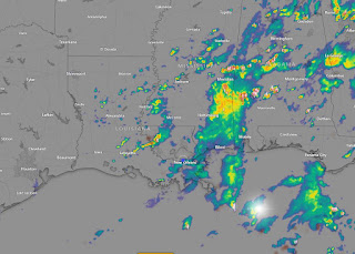
The wave entering the southern Gulf is interacting with an upper low. No model does anything with this & NHC appears not concerned so neither should we. While I was on the air, I hated using rain chances. Instead I used "above normal" or "below normal" shower activity. The upper pattern has us in the "above normal" range for the next several days. Why? The answer is in the upper air pattern.
The "Heat Dome" is centered over the Rockies with an upper trough over the eastern states. In addition, an old frontal boundary is stalled along the Gulf coast. That is way different than last year. Zack Fradella showed us this comparison this morning.
We've had nearly 30 more inches year to date, and more rain at this time of the year means less hot.
You don't have to travel too far to the north to get into the good feel air. It's not coming here!
Until the weak upper low to the NW weakens & the surface front dissipates, look to see above normal showers and below normal temperatures into next week.
Finally, Dr. Knabb on TWC had a great graphic this afternoon. Wish I had grabbed it, but it featured August of 2004. That year there were no (zero) named storms in June & July, but August exploded with 8 storms. September proved just as active, so let's not get giddy that we're so quiet. In 2004, Florida was the bullseye for landfall. We all know what happened in 2005!
Remember the Tarpon Rodeo begins next Thursday and you can still register for an opportunity to win the Grand Prize of $10,000. You don't need to be present. Go to www.tarponrodeo.org to register. Stay tuned!


.jpg)


No comments:
Post a Comment