
One of my standard "rules" to follow is I don't start to get concerned until the Hurricane Specialists begin talking about an INVEST area. That has not happened yet out in the Atlantic, but NHC's thinking continues to favor development by late this week as a tropical wave nears the Bahamas. They keep probabilities near zero in the short (2 day) term time frame and the water vapor loop shows why.


Clearly, surrounding the tropical wave is nothing but dry air & upper lows (T.U.T.T.). In the short term (2-3 days) the atmospheric environment remains very hostile for development. One thing that is gone is the SAL (dust) layer coming off of Africa.


But ahead of the dust layer, I've circled two small low level swirls well east of the Islands. Of note, there are no storms around the eastern swirl with only a few on the west and south sides of the western swirl. It's center appears exposed indicating any development will be slow. So where are the models taking this something that hasn't formed yet? Let's begin with the Euro.


The top view is valid for Sunday morning where the Euro has a weak Depression/Storm off the east coast of Florida. The bottom graphic is valid for Tuesday morning taking whatever might form inland near Charleston. But, as usual, the GFS does not agree. We begin with the GFS valid for Sunday morning having NOTHING.


The middle view is valid for next Tuesday morning with hints of a swirl ESE of the mouth of the River. The bottom graphic is valid for NEXT Thursday with the GFS suggesting little movement and slow development just east of the Louisiana coast. Again, the further out in time, the greater the uncertainty in the models. I think the take away from both models is neither develops a major system. Nothing may form or perhaps a Tropical storm at worst.? I like all the upper low across the Tropics, plus we currently have a blocking Heat Dome over us. It's not as powerful as last year, but it should steer anything that forms to make the turn AWAY from the Gulf. We'll watch and see.

Unless something drastic happens, the next named storm (Carlotta) will be in the EPAC (Eastern Pacific).

Over the U.S., there remains a trough off the West Coast, a ridge over the Rockies with a broad trough over the East. A weak Nor'easter has brought Gale Warnings to New England.

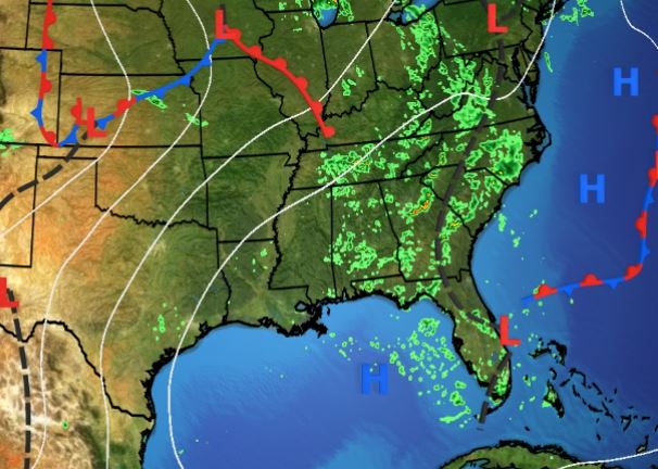
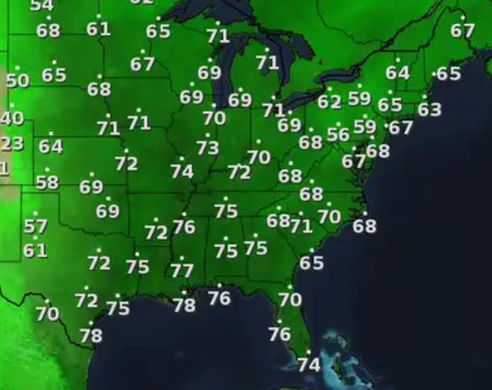
Those low dew points up north have been replaced by 70+ DPs all the way to the Canadian border. Ugh! Locally, rain coverage was way less today as only a couple T-Storms bubbled up.


The rest of this week will be basic summertime heat with slightly below normal rain coverage. Satellite views of the West reveals the annual smoke plumes from many fires.


California had another rainy season that filled up the reservoirs, but it also has resulted in much vegetation growth. Once the rains stopped, that growth starts to dry becoming fuel for wildfires. It's a nasty cycle that has no easy solution as more and more folks have built into hillsides and harm's way. Stay tuned!
No comments:
Post a Comment