
Frankly I'm bored talking about the daily August heat, so let me begin with some of my flowers that are surviving & thriving this summer stress. Now many of my annual cool weather bedding plants were pulled back in June with the begonias being the last ones standing. Some of my potted plants are OK with the best looking bush being my Allamanda just off my driveway. I have another in a pot in the backyard that is green, but has no flowers right now.


I'm not sure what the bottom bush is called, but it's loving the heat, but it is in the shade. Ok, back to the Tropics. We are in the heart of Hurricane Season and there is only one storm to track. The Atlantic remains strangely quiet despite a favorable MJO phase.


Hurricane Ernesto remains a Cat. 2 as he aims for Bermuda. NHC indicates his cloud & radar structures have improved, but they feel he may have peaked in intensity. Still, Bermuda is going to get a good wrack. For our weather, the Heat Dome appears to be shifting back to the Rockies as several pulses of upper energy deepen the East coast trough.
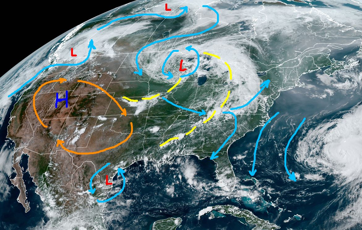

That should result in drier air coming for NEXT week. Before then, we should see some spotty storms like today. One formed right over Harahan/River Ridge around 2:30 pm.


.jpg)
.jpg)
But if you're looking for any really cooler air, that's called October! Finally, besides Ernesto near Bermuda, there is only one other named storm worldwide.

Typhoon Ampil brushed by Japan keeping the eyewall just offshore. None of our computer models develop anything for the next 7-10 days. Wouldn't it be nice to get out of August with only one named storm? Stay tuned!
No comments:
Post a Comment