
Shortly after I posted yesterday, the news of Ed Daniels passing reached Face Book. I salute all the stations (not just Ch. 26) for acknowledging the work Ed did over the decades. When I arrived at Ch. 8 back in 1978, Ed was a Loyola student doing intern work for Buddy Diliberto. Even back then he seemed "intense/passionate" about sports. I lost track of him after Buddy went to Ch. 6 with Ed taking a job in Lake Charles. It was not until about 5 years ago that I met Ed again at the Archdiocese's annual men's day of prayer. Karen Swensen & I were there to talk about our Faith after losing a spouse. Ed's talk was about Faith, Family & Friends and that's when I saw the hard driving sportscaster was really a gentle man.

So don't feel sad for Ed as he lived his dream, being a sports director in his home market. Our prayers go to Robin and their family as they embark on the Grief Journey, a journey that is hard, long and never ends. RIP Ed Daniels. It was an honor to share the stage with you if only for a day. Back to talking weather & the Tropics.


The next 6-8 weeks is the real heart of the Hurricane Season, where most of the major storms develop from waves coming off of Africa. But as you can see, there are no waves. Why? Saharan Dust? Maybe? You can see Ernesto in the top left of the bottom view. he is leaving Bermuda and heading out to sea. But notice the tail of moisture wrapping around him back over Florida.

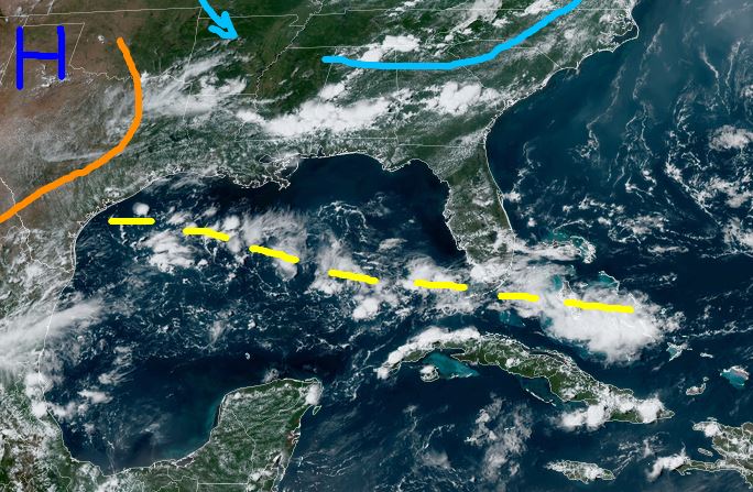

None of the models have anything forming during the next 7 days. Both GFS & Euro hint at something forming over the Gulf to our south in the 10-14 day time frame. If we are going to see a tropical threat for the rest of this month, we need to watch closely the Gulf as fronts are expected to push down from the north. Remember back in 1983, Hurricane Alicia developed from an old cold front that drifted offshore to our south. Why are fronts coming in August?

An unusually deep upper East coast trough has parked itself over the Great Lakes forcing the Heat Dome back to our west. Notice the boundary in the Gulf, but there is another just to our north.


No comments:
Post a Comment