
As we approach the peak (Sept. 10) of Hurricane Season, historically this is the time when tropical systems "take off". In past years, any swirl that got over the Gulf usually developed, sometimes very rapidly. But that is not happening this Summer. For sure, we had Beryl & Debby in the Gulf and it appeared the "hyper-active" (as predicted) season was here. But ever since Ernesto 3 weeks ago, NaDa, Zilch, nothing as if something has flipped the development switch to off. NHC has highlighted an area out in the MDR for a slight chance for developing, but to me, the system behind it has more potential.


The first wave (white dashes) lacks any T-Storms while the second looks far more robust. IF it does develop, we'll have nearly 2 weeks to watch it with it most likely turning to the north before threatening the U.S. So let's focus on closer to home in the Gulf. A strong wave is moving across Florida with another boundary setting up across the Western Gulf.


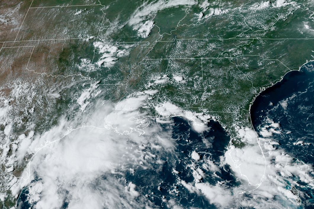
There are several swirls that I've plotted with the one inland NW of Houston being the old upper low moving to the north. There appears to be a small rotation on radar south of Houston with another low level rotation west of Tampa. Yet another is down over the southern Gulf. Will any of them start to organize? Probably not as the SW upper shear is rather strong. But since that upper flow is part of an upper High over the southern Gulf, that is allowing for a split flow that enhances surface lift. Bottom line, beware of the warm Gulf in late August into early October. The upper Heat Dome is shifting to our north & east and WEAKENING.


We have no fronts around so our rain chances will come from these tropical disturbances as a moisture laden air mass covers all of the Southeast.


Some folks received a good soaking today, while other (like me) got just a few sprinkles. IF the Weather Prediction Center's (WPC) forecast proves to be reality, the next 3-5 days will be very wet for many.


The bullseye for heaviest amounts (6-12") is along the upper Texas coast and SW LA. However, 7 day amounts of 3-5" appear possible south of Lake P. with 1-3" north of the Lake. Remember, 80% chance for rain doesn't mean it will rain 80% of the time. There could be many sunny hours between showers.

One benefit for above normal clouds and showers is less hot temperatures. Now all we need are cold fronts! Finally, Typhoon Shanshan has weakened as it moves over Japan.


All the systems around Hawaii have also weakened in this year of below average/normal activity worldwide. Zack Fradella had an excellent explanation on FOX 8 at 4 PM as to why the Tropics have been so quiet. Hope you saw it? Go to their website to see if they posted it. Stay tuned!
No comments:
Post a Comment