
Once NHC started to include an area to watch on their TWO (Tropical Weather Outlook), media jumped on it saying the tropical switch is about to flip. Or is it in this summer of suppression/sinking air? The next name will be Francine, but where will she form? The MDR from a wave coming off of Africa? A well defined swirl SE of Bermuda? Or from several waves moving through the Caribbean? Heck, how about the Gulf? Let's discuss.


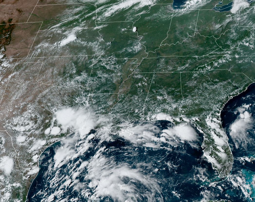
Looking at the MDR (Main Development Region) finds nothing is there yet. In fact, the best swirl is still back over Africa and models don't do much with any of these disturbances for the next 7-10 days.. OK, what else might develop? There is a well defined swirl SE of Bermuda.(yellow circle)


Some storms have fired off on the northern side of the circulation, but strong southerly shear has the center exposed. NHC isn't talking about it. So what about the Caribbean?


There are several weak waves, but I'm more interested on the Gulf. The upper low we've followed for several days is well inland over Texas. But there remains a lot of storm clusters behind it into the southern Gulf where it appears a weak swirl is NW of the Yucatan. In addition, I see another weak rotation south of Panama City. None of the models do anything with these features, but I think we need to pay attention to the Gulf for the rest of this week. No, not that any major storm might form. Rather, tropical moisture could become more concentrated and move towards the northern Gulf coasts later this week. For now, there's nothing. The upper Heat Dome continues shifting to the east and is weakening.


Recall August 2023 when we were right under that dome setting record after record, peaking with 105 on the 27th.


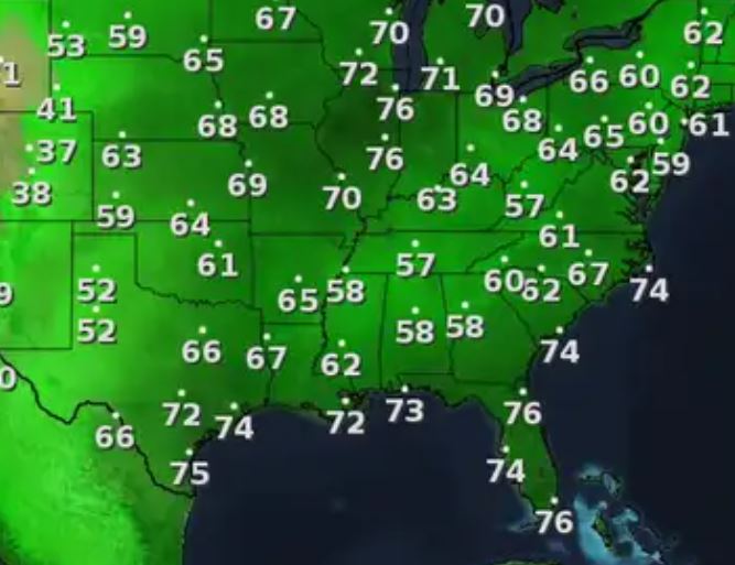
Look at temperatures under the dome to our north. With dew points in the mid 70s, it feels much worse in St. louis & Chicago than here.


.jpg)
.jpg)


If you have friends in Japan, pray that Typhoon Shanshan will weaken as the path brings it right across the island. Let's pay attention to the Gulf for the rest of this week in case a heavy rain event heads our way. Stay tuned!
No comments:
Post a Comment