
As many of you who have followed me over the years know, I have been critical of NHC naming storms right before landfall. Why? Because once a storm is named, our "Hurricane Deductible" kicks in. For most of us, that's multiple thousands of dollars out of our pockets before insurance will pay anything. That of course saves insurance companies millions of dollars. In the case of PTC # 8, NHC consistently has said it has some tropical characteristics, but they will NOT name it Helene. Why? Let me explain the set up.


I thought Jim Cantore explained it best this morning on TWC. The top view shows a leftover frontal boundary that extends way out into the Atlantic. There are 5 distinct lows along this boundary (TD Gordon is down in the SE corner) with PTC # 8 being over the Carolinas. It was not named for two main reasons. 1) Recon aircraft could not find any west surface winds that would confirm a low level circulation, but more importantly, 2 ) it didn't have a warm core, but was more like a winter-like system similar to a nor'easter. Impacts were like a TD or TS (Tropical Storm warnings were issued), but my understanding is, until NHC gives it a name, that dreaded hurricane deductible doesn't kick in. If any insurance agent in the Carolinas knows better, please let us know. Hopefully, any damages will be covered by folks with insurance?


Connected to that boundary across the Carolinas is a swirl that is all that's left of Francine. It has triggered a few showers, but nothing like the flooding rains over the Carolinas.


So the next thing we'll focus on is real cold fronts coming as we approach October. No signs of that this week over the eastern states, but look out to the West coast.


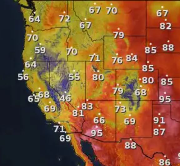
A deep upper trough is over Nevada bringing much needed cooling relief to California. We need that upper trough to redevelop over the east coast as we head into October to bring the real chill down to us. I'm afraid that won't happen in the next 10-14 days. What we'll have to pay attention to is the Caribbean and southern Gulf NEXT week. Several models (GFS, Canadian) are indicating a strong system will develop. Here's the GFS model valid for NEXT Wednesday midday. The middle view is valid for Friday the 27th.


The bottom view takes whatever forms westward into Mexico on the 29th. #1) beyond 10 days, models often project storms that never form. #2) IF a storm/hurricane does develop, those early projections are rarely accurate. Bottom line, We're in the heart of hurricane season for another 2-3 weeks. You should all know, history often repeats itself and there are many years where multiple storms hit the same areas twice. (Pensacola 1995). No time to get complacent.


We have a few showers around, but that hasn't kept temps below 90. This week will still feel very much like summer despite the Autumnal Equinox (beginning of Fall) arriving Sunday at 7:43 AM. No complaints since our Who Dats smothered the Cowboys yesterday. As Jackie Gleason would say, Oh HOW SWEET IT IS !!! Stay tuned!
No comments:
Post a Comment