
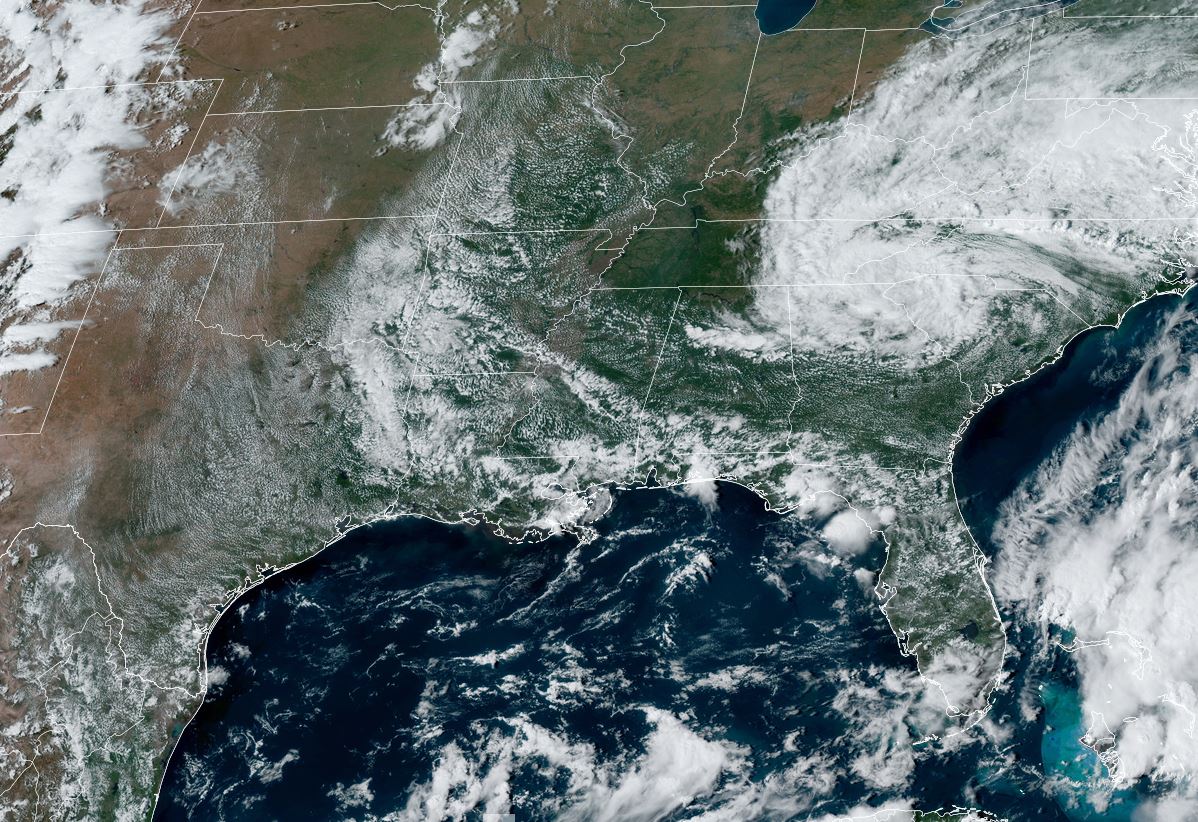
We passed the peak (Sept. 10) time for hurricane activity a week ago dealing with Francine. Yesterday saw a strong system slam North Carolina. Joe Bastardi of WeatherBell Analytics suggests it should have been named Helene since ground truth wind gusted to near 80 mph and it HAD to be warm cored since rain totals were 15-20". Humm, NHC indicated PTC # 8 was connected to an old frontal boundary & Recon data couldn't find a low level center. But damage is damage regardless of whether it was named or not. Fortunately, the tropics will take a nap for about a week before the next activity erupts next week. Right now, there is nothing happening between Texas to Africa.


There are several swirls out in the Atlantic with NHC downgrading the remains of Gordon to a trough. The closer we get to October, the less concern we have for watching waves coming off of Africa. It takes roughly 2 weeks to cross the Atlantic & Caribbean before threatening us. That gets us to October when cold fronts start arriving turning any tropical disturbances away from us. Historically, we need to focus closer to home, like the NW Caribbean & Gulf. For now, there is nothing there.


So why am I even mentioning this concern? Because several models again today develop a Tropical Storm/Hurricane for NEXT week. I showed you the GFS yesterday taking the system across the southern Gulf into Mexico. Look where it takes it in today's model run. The top view is valid for NEXT Tuesday followed by Thursday & Friday.


Wow, what a flip-flop! From Mexico south of Brownsville to north of Tampa Bay. It's why you don't bet the house on model projections beyond 3-5 days. The reason I even talk about a ramp up in tropical activity towards the end of September, is I know many of you take trips (DisneyWorld, Florida beaches etc) and I want you to pay attention to the weather so you have no surprises. Seeing how this season has gone so far, perhaps nothing will develop? We just need to start seeing fronts coming down south. It is getting colder up in Canada & Alaska.


Unfortunately, that cold air can't come our way until the upper trough over the Rockies shifts to the East coast. Right now, we have a weak cut off upper low over the Carolinas, but no deep trough.


As you can see, there is no cold air around for this week. Some storms developed during daytime heating today. The trend should be for fewer storms for the rest of this week.


We are not done with highs 90+, but with the lower sun angle and shorter days, it's not like August anymore, Let's enjoy this new lull in the Tropics and I'll keep giving you any updates if models keep showing development for next week. Stay tuned!
No comments:
Post a Comment