Despite remaining just offshore of the coast of Honduras, Tropical Storm Sara is struggling to survive as at least half of her circulation is over land. NHC is not aggressive regarding any further strengthening and is calling for her to dissipate into an open wave over the Yucatan. The main impact from Sara is heavy rainfall due to her slow (west at 5) forward motion.
You can tell on the satellite views, especially the color infrared, that Sara is poorly organized with no storms around her center. The reason NHC is not forecasting redevelopment over the Gulf is all the upper dry air, along with increasing westerly wind shear, should limit any strengthening.
The Spaghetti Plots makes it look like there will be something to follow as Sara's remains move into the Gulf.
That deep upper trough over the Rockies will shift to the east creating a "wall of wind shear" over the northern Gulf turning any remains of Sara to the east. As a strong cold front approaches on Tuesday, we need to pay attention for some of Sara's moisture interacting with the cold air that might produce some strong storms. And the cold air is coming! Look at the changing upper pattern flip-flop.
On top is today's upper flow with a trough over the Rockies and a ridge over the East. The bottom view is valid for Thursday morning that has a deep upper low over the Great Lakes that will allow for the coldest air since last March to return to the deep South. Check out the chill over Canada & Alaska.
Much of Alaska is below zero with most of Canada below freezing. Low level moisture is already coming out of the Gulf as the surface highs shifts to the east.
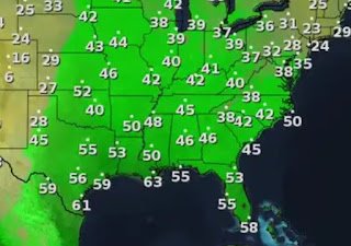
Our dew points that were in the 40s have already jumped back above 60. By late Sunday into Tuesday, look for that real muggy feel (dew points 70+) to be back. But it won't last all week as that strong front will take us from shorts & tank tops back to heavy coat weather.


No comments:
Post a Comment