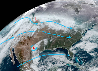
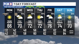
The Arctic high that brought most of the eastern states a "Christmas feel" is shifting to the east. As it does, our winds will turn more easterly on Monday and SE on Tuesday. That will allow a return flow of Gulf moisture & milder air. You'll notice it as our clear skies start to see some clouds.
Very low/dry dew points linger over us, but that will change on Tuesday and for the rest of this week. The east coast upper trough has lifted out as milder Pacific air streams into the country. The cold surface high is retreating as the warmer air surges out of the Gulf.
It is still frigid over the Northeast with a snow cover, but see the 60s surging as far north as Nebraska. After tonight on the North Shore, I see no more freezes into the New Year.
In fact, as the 70s return, our main issue will be the dense morning fog beginning as soon as Tuesday but more likely on Christmas. Alas, we have zero hope for a White Christmas here and across all of the South. It will feel more Spring-like than the first week in Winter. Stay tuned!


No comments:
Post a Comment