All right, let's get straight to the chances for another snow here this week. Not gonna happen because we will not be cold enough. Remember back in January, we got deep into the cold (20s) before a low formed down in the Gulf. This time, we will be well above freezing with the snow line far to our north. Here's the forecast map for Tuesday PM.
As you can see, all of Louisiana is in the rain with the frozen stuff across OK/AR/TN. So the next question is...will it freeze behind the low & cold front for later this week. For the North Shore, maybe. For the South Shore, I don't think so. Several reasons factor into that opinion. The first (top graphic) has the super cold (20-25 below) over eastern Canada.
And the Polar Vortex dives over the Northeast (middle graphic) and not down to us. Contrast that to the bottom graphic valid for the following Monday (2-24). Notice how that trough dives down to us. So even though most forecasts are calling for a hard freeze North Shore & a light freeze south, I don't see it. We have days to watch it.
What I did today is move my more tropical (bougainvilleas. Hibiscus) potted plants into my He-Shed. I'll wait until later this week before I decide whether to start covering the in-ground stuff again. Remember last night's severe threat?
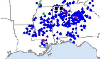
It pretty much verified with all of the action north of Lake P. An EF-1 tornado touched down near Varnado in northern Washington Parish. Only 3 confirmed tornadoes touched down despite a level 3 risk.
The colder air continues to pour into Louisiana, but my thinking is the core of the cold will blow to our north & east. Stay tuned!


No comments:
Post a Comment