
We are in day 13 of no rain and I have yet to watch a weather program that points that out. All you keep seeing is increasing rain chances. Every thing I'm seeing keeps the surface frontal boundary stalling to our west. Without that, I don't see a trigger to develop much in the way of shower activity. SPC kind of supports that idea in their daily Severe Risk outlook. We begin with today, followed by Sunday and then Monday.


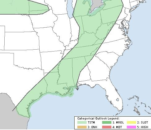
Obviously, there will be a widespread severe threat (Level 3) on Easter Sunday, but it will stay well to our north as that's where the upper energy is going. Note the bottom graphic has no severe storms anywhere. Sure we might see a stray shower Monday, but when in a dry spell/drought, leave it out. Here where the upper low is now.


Even WPC's 7-day rain total gives less than an inch for SE LA/MS. We do have lots of clouds, but no rain across Louisiana.


So let's watch that surface boundary for tomorrow & Monday. If it stays well to our north and west, it's likely to stall and retreat back to the north later next week.
.jpg)
Just watched Ch. 6 and they are calling for 60% rain chances on Monday & Tuesday. Why? Because the model says so. At least Ch. 8 is 40% and I'm thinking 20-30% might be generous. Let's see what happens. Dry spells are often difficult to break. Happy Easter and stay tuned!
No comments:
Post a Comment