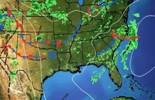
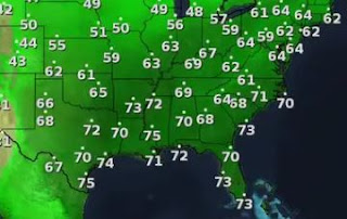
It's almost funny to see these models flip-flop in the 10-14 day time frame. The GFS is notoriously wrong beyond 10 days and keeps trying to form storms hither, yither & yond. Stop believing in that nonsense. I don't see anything development happening during the next 7-10 days+ in the Atlantic. Maybe in the EPAC, but not in the Caribbean & Gulf.
We all know it's June. It's supposed to be hot & humid with spotty showers. So I see very little change until a frontal boundary gets closer next Tuesday-Wednesday.
It definitely is cooler & drier north and west of the front. But that front is likely to stall well to our west, keeping the heaviest rain totals to our west and north NEXT week.
IF we get into more clouds and rain, that should keep us less hot. But I'm not sold on that. Hot & humid with a spotty shower next 3 days. Stay tuned!


No comments:
Post a Comment