
If you ever have problems with the Facebook posting of this blog, you can always go to bobbreck.com and read my post there. NHC has increased chances for development over the northern Gulf from 20 to 30%. I believe in their 1 PM update, they will increase chances to 40 or 50% as they have placed the Hurricane Hunters on alert to fly tomorrow. I see 2 low-level swirls on satellite and radar.


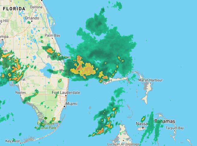
The middle view shows where I see a low-mid level circulation with strong NE shear (lt. blue arrows) blowing across it. The bottom is the radar that has a weak rotation just north of Freeport, Bahamas. So will they develop? NHC is scheduled for tomorrow, so they don't expect much today due to strong upper shear. This whole area is currently in a hostile environment of upper wind shear
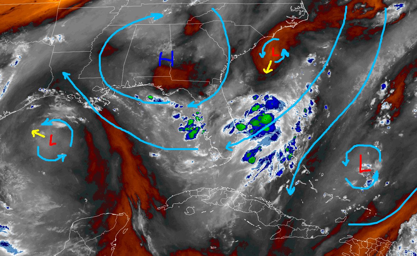

That will change as this system gets into the Gulf Wednesday through Friday. One model forms a weak closed low (TD or TS?) by late on Wednesday.

I like the way FOX 8 is handling the future predictions. "This won't be a major wind issue, but it might be a flood issue." Here's the EURO AI rain forecast beginning with today on top.


It's followed by Wednesday, Thursday, Friday & Saturday, keeping the heaviest rains off our coast. However, this will be a slow mover and we will be on the wet side through Saturday. Could we see 5-10"+ over 3-4 days? Absolutely, but whatever forms (Dexter?) should not be life-threatening unless one is stupid. I'll update today after 4 PM. IF we are to have any issues, it will be late Wednesday into Saturday. Slow-moving tropical systems can produce life-threatening impacts, and that's why we'll need to pay attention later this week. Stay tuned!
No comments:
Post a Comment